- Corstorphine, New Zealand
-
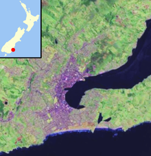
 CorstorphineLocation of Corstorphine within Dunedin
Corstorphine is a suburb of southwest Dunedin in the South Island of New Zealand. It is located on the slopes of Calton Hill - a spur of Forbury Hill - between Caversham Valley and the Pacific Ocean. The suburbs of Saint Clair and Forbury lie to the east and south, and Caversham and Lookout Point lie to the north.
Corstorphine is a largely residential suburb, containing a substantial amount of state housing built from the 1930s to the 1960s. Its main roads include Middleton Road, Sidey Street, and Corstorphine Road. A small group of shops is located at the top of Middleton Road.
To the west is largely rural land, connected via the rural Blackhead Road and Green Island Bush Road to Green Island and Waldronville. The popular Tunnel Beach lies 1.5 kilometres from the top of Middleton Road and is accessed via Blackhead Road.
On the lower slopes lies the smaller suburb of Kew. Here, Easther Crescent runs along a terrace at the edge of the hill, connecting with Saint Clair at Allandale Road to the south and descending to Forbury Corner and Caversham in the northeast. Kew Park lies at Forbury Corner itself. To the north of Corstorphine, the smaller suburb of Calton Hill connects Corstorphine with the upper Caversham Valley and Lookout Point by way of Riselaw Road.
The name "Corstorphine" comes from the house and land owned by early settler John Sidey, who arrived in Dunedin in 1848.[1] It originates from the Edinburgh district of Corstorphine.[2] Many of the streets in Corstorphine and Kew are named after places in Scotland, among them Skibo Street, Dornoch Street, and Lockerbie Street.
Sidey's son, Sir Thomas Sidey became a prominent local and national politician during the later nineteenth century. Sidey's residence, Corstorphine House, was built in 1864 and was substantially extended in 1910.[3] It is one of the suburb's main landmarks.
References
- ^ Herd, J. and Griffiths, G.J. (1980) Discovering Dunedin. Dunedin: John McIndoe. ISBN 0-86868-030-3, p. 47
- ^ Reed, A.W. (1975) Place names of New Zealand. Wellington: A.H. & A.W. Reed. ISBN 0-589-00933-8 p. 92
- ^ Herd, J. and Griffiths, G.J. (1980) Discovering Dunedin. Dunedin: John McIndoe. ISBN 0-86868-030-3, p. 47
Suburbs of Dunedin Central city Main urban area - north Balmacewen · Burkes · Dalmore · The Gardens · Glenleith · Leith Valley · Liberton · Maia · Maori Hill · Mount Mera · Normanby · North East Valley · Opoho · Pine Hill · Prospect Park · Ravensbourne · St Leonards · Wakari · WoodhaughMain urban area - east Main urban area - south Andersons Bay · Corstorphine · Forbury · Kensington · Kew · Musselburgh · Ocean Grove (Tomahawk) · St Clair · St Kilda · Shiel Hill · South Dunedin · Sunshine · Tahuna · TainuiMain urban area - west Abbotsford · Balaclava · Belleknowes · Bradford · Brockville · Burnside · Caversham · Calton Hill · Concord · Glenross · Green Island · Halfway Bush · Helensburgh · Kaikorai · Kaikorai Valley · Kenmure · Littlebourne · Lookout Point · Maryhill · Mornington · Roslyn · SunnyvaleSurrounding districts Aramoana · Brighton · Broad Bay · Careys Bay · Company Bay · Evansdale · Fairfield · Harington Point · Macandrew Bay · Mosgiel · Ocean View · Otakou · Port Chalmers · Portobello · Pukehiki · Roseneath · Sawyers Bay · Waitati · Waldronville · WingatuiCoordinates: 45°54′16″S 170°28′15″E / 45.9045°S 170.4709°E
Categories:- Suburbs of Dunedin
- Otago Region geography stubs

Wikimedia Foundation. 2010.