- Dunedin North
-
For the political constituency, see Dunedin North (New Zealand electorate).
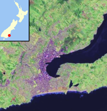
 Dunedin NorthThe location of Dunedin North within Dunedin's main urban area. The light green area immediately to the west is Logan Park.
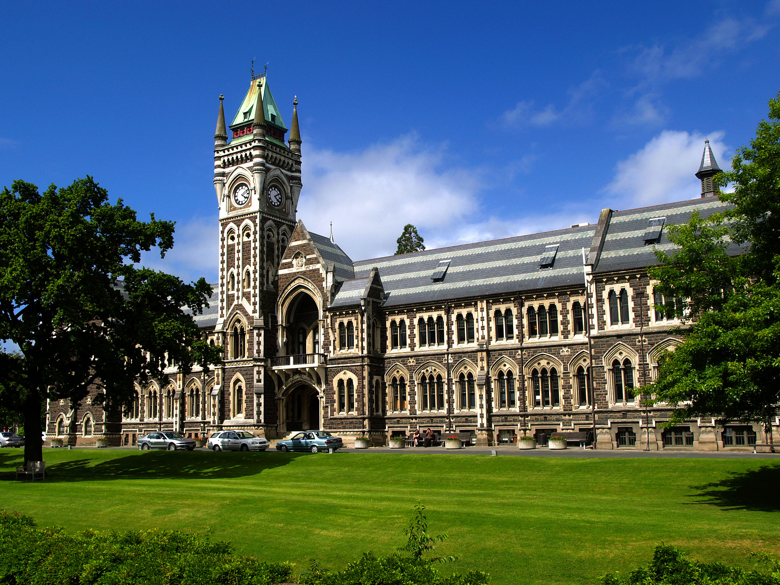
 University of Otago clocktower building
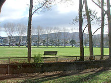 Logan Park
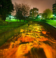 The Water of Leith flowing through the University of Otago after heavy rain
Dunedin North, also known as North Dunedin, is a major inner suburb of the New Zealand city of Dunedin, located 1.5 kilometres (0.93 mi) to the northeast of the city centre. It contains many of the city's major institutions, including the city's university, polytechnic, main hospital, and largest museum. Dunedin North's 2001 population, including the University area, was 7,047.
Dunedin North is located immediately to the north and northeast of the city's CBD. The suburb of Woodhaugh lies immediately to the northwest, and Dalmore and the Gardens Corner lie to the north. It is centred on a widening of the inner city plain around the lower reaches of the Water of Leith, and on land reclaimed from the Otago Harbour, including the former Pelichet Bay. The suburb is not entirely flat, however; a spur of Signal Hill extends across the plain to the south of the Dunedin Botanic Gardens, rising into the small peak of Tani Hill immediately to the northeast of the University of Otago. The hill's name, not officially recognised and nowadays rarely used, is a corruption of "Botanic Hill", and dates from the time when the Dunedin Botanic Gardens were located on the site now occupied by the university. Two university halls of residence, Arana College and Studholme College, sit close to the peak of Tani Hill.
Dunedin North's main streets include George Street, Castle Street, Cumberland Street, Great King Street, and Anzac Avenue. These latter four roads form part of New Zealand's State Highway network, with Castle, Cumberland, and Great King Streets all being part of State Highway 1 (as well as being part of the city's one-way street system), and Anzac Avenue being part of State Highway 88 between Dunedin and Port Chalmers. The first four of these streets run parallel to each other, and all five are connected by numerous cross streets such as Albany Street, Dundas Street, and Frederick Street in a grid pattern interrupted by the campus of the University of Otago.
The University is the most notable feature of Dunedin North, covering 25 hectares (62 acres) of the suburb. Its central campus is roughly bounded by Cumberland Street, Albany Street, St. David's Street, and Clyde Street. Immediately to its east lies the Otago Polytechnic, and beyond this the University of Otago College of Education. Between this and the mouth of the Leith is an area of former industrial and warehousing land which is the site of the new Forsyth Barr Stadium at University Plaza, currently[update] under construction.
Immediately to the north of the College of Education is a wide expanse of open parkland, Logan Park. This contains some of the city's main sports grounds, notably the Caledonian Ground and the University Oval, the latter being a Test cricket venue. Logan Park High School, one of the city's larger high schools, is located close to the Caledonian Ground in the northeast corner of the park. The small Opoho Creek flows along the edge of Logan Park before its confluence with the Leith close to the latter's mouth. The mouth of the Leith is also the location of the Otago Yacht Club. At the eastern edge of Logan Park is the Logan Point quarry, which State Highway 88 skirts the edge of between Dunedin North and the neighbouring suburb of Ravensbourne.
Beyond the institutional heart of the suburb, Dunedin North is primarily residential, with much of the area occupied by student flats. As such, Dunedin North and the neighbouring suburbs of The Gardens and North East Valley are often considered New Zealand's principal student ghetto. There is little in the way of industrial property within the suburb, although there is some light industry in the southeast close to Anzac Avenue, and Gregg's coffee factory is located close to Otago Polytechnic.
Other notable features of Dunedin North include Otago Museum, located immediately to the east of the University, and Dunedin Public Hospital, which lies at the southern edge of Dunedin North surrounded by university buildings which are part of the Otago Medical School. One of the city's most architecturally important churches, Knox Church, sits to the west of the hospital at the point where North Dunedin joins the CBD. In the north of the suburb lie the Dunedin Botanic Gardens, and above them one of the city's most historic cemeteries, the Northern Cemetery.
Suburbs of Dunedin Central city Main urban area - north Balmacewen · Burkes · Dalmore · The Gardens · Glenleith · Leith Valley · Liberton · Maia · Maori Hill · Mount Mera · Normanby · North East Valley · Opoho · Pine Hill · Prospect Park · Ravensbourne · St Leonards · Wakari · WoodhaughMain urban area - east Main urban area - south Andersons Bay · Corstorphine · Forbury · Kensington · Kew · Musselburgh · Ocean Grove (Tomahawk) · St Clair · St Kilda · Shiel Hill · South Dunedin · Sunshine · Tahuna · TainuiMain urban area - west Abbotsford · Balaclava · Belleknowes · Bradford · Brockville · Burnside · Caversham · Calton Hill · Concord · Glenross · Green Island · Halfway Bush · Helensburgh · Kaikorai · Kaikorai Valley · Kenmure · Littlebourne · Lookout Point · Maryhill · Mornington · Roslyn · SunnyvaleSurrounding districts Aramoana · Brighton · Broad Bay · Careys Bay · Company Bay · Evansdale · Fairfield · Harington Point · Macandrew Bay · Mosgiel · Ocean View · Otakou · Port Chalmers · Portobello · Pukehiki · Roseneath · Sawyers Bay · Waitati · Waldronville · WingatuiCoordinates: 45°51′49″S 170°30′53″E / 45.8636°S 170.5146°E
Categories:


Wikimedia Foundation. 2010.