- Corral Hollow
-
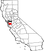
Corral Hollow, formerly El Arroyo de los Buenos Ayres, (The Creek of the Good Winds) a canyon with part in Alameda County and parts in San Joaquin County, 6.5 miles Southwest of Tracy, California. Corral Hollow Creek from its source 1.9 miles north of Mount Boardman, flows north 1.89 miles where it turns to flow west-northwest 8.5 miles then turns abruptly east in the vicinity of Tesla to flow 5 miles east whare it turns again in a northeasterly direction for 6 miles to the Delta-Mendota Canal in the San Joaquin Valley.[1]
Corral Hollow, History
The name "Arroyo Buenos Ayres" appears on on the Charles Drayton Gibbes' "Map of the Southern Mines" in 1852.[2] The El Camino Viejo, passed to the west through El Arroyo de los Buenos Ayres over the Portezuela de Buenos Ayres (Good Wind Pass) to the Arroyo Seco and the Livermore Valley. The '49ers passed through the canyon now named Corral Hollow on their way to the gold fields as did the first mail to the Tuolumne mines. The name change was perhaps because at its mouth there was a large corral for catching wild horses. This "caral" was mentioned in the California Star on March 18, 1848:
- "We are credibly informed...that a number countrymen with several Californians are actively engaged in building an extensive caral, or enclosure, in the valley of the river San Joaquin, for the purpose of capturing wild horses. The caral...will enclose twenty-five acres of land..."[3]
California Landmark 755, indicates the site of the home of its first settler, Edward B. Carrell, which was built here at the former site of an Indian village. The men and animals received food and drink at Wright's Zink House, five hundred yards north of the landmark site.[4] California Landmark 755, (now missing), was located 1.5 miles west of I-580 on County Hwy J2, Corral Hollow Road.[5] (Coordiates on this page mark that site.)
Some miles up the Corral Hollow Road in the canyon is the site of the former town of Carnegie. A few miles on, beyond the Alameda County line where the road becomes the Tesla Road, is the coal mining area and the site of the former town of Tesla where coal was mined from 1855. Tesla appeared in 1889, as the San Francisco & San Joaquin Coal Company built the Alameda and San Joaquin Railroad line to the coal mines. When clay was discovered in the coal mine, the Carnegie Brick and Pottery Company was formed in 1902, its plant built four miles east of Tesla, to make brick and terra cotta. In 1904, the Pottery sewer pipe plant was built between Carnegie and Tesla. Carnegie became a town with a population of about 300, Tesla had a population of over 1200. The towns were abandoned after a 1911 flood, which destroyed the railroad and workings and the Company could not afford to rebuild. The rail line from Carbona was abandoned by the Western Pacific Railroad in January 1916.[6]
The canyon turns to the southwest beyond the site of Tesla and ascends into the hills back into San Joaquin County. After passing the site of Tesla, the Tesla Road turns northwestward and winds up the side of a canyon into the Buenos Ayres Pass and crosses over to the Arroyo Seco, and follows it as it decends into the Livermore Valley.
Today the former town site of Tesla is within the Carnegie State Vehicular Recreation Area. Carniege town site partly within the Recreation Area, the rest is on the hillside on the north side of the Tesla Road where it intersects Carnegie Ridge Road.
References
- ^ GNIS Feature Detail Report for: Corral Hollow Creekaccessed November 8, 2011
- ^ Map of the southern mines: (Calif.) 1852 by Charles Drayton Gibbes, The Bancroft Library, University of California, Berkeley, CA 94720-6000
- ^ Erwin Gustav Gudde, California Place Names, 3rd Edition, University of California Press, 1974, p.75-76 Corral Hollow: Canyon, Creek, Pass
- ^ Mildred Brooke Hoover, Douglas E. Kyle, Historic spots in California, p. 378.
- ^ California Landmark 755
- ^ Dan L. Mosier, Brief History of the Tesla Area
Coordinates: 37°39′28″N 121°28′38″W / 37.6579°N 121.47724°W
Municipalities and communities of Alameda County, California Cities Alameda | Albany | Berkeley | Dublin | Emeryville | Fremont | Hayward | Livermore | Newark | Oakland | Piedmont | Pleasanton | San Leandro | Union City
CDPs Ashland | Castro Valley | Cherryland | Fairview | San Lorenzo | Sunol
Unincorporated
communitiesAlbrae | Altamont | Asco | Baumberg | Brightside | Brookshire | Carpenter | Dougherty | Dresser | East Pleasanton | Farwell | Hall Station | Halvern | Kilkare Woods | Komandorski Village | Lorenzo Station | Mattos | Mendenhall Springs | Midway | Mountain House | Mowry Landing | Radum | San Ramon Village | Scotts Corner | Sorenson | Verona
Former settlements Alden | Alvarado | Ann | Decoto | Drawbridge | Eden Landing | Elliot | Goecken | Greenville | Hacienda | Hayward Heath | Laddville | Larkin's Landing | Mallard | Melita | Merienda | Monte Vista | Remillard | Robert | Russell City | Stokes Landing | Tesla
Municipalities and communities of San Joaquin County, California Cities 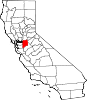
CDPs Acampo | August | Collierville | Country Club | Dogtown | Farmington | French Camp | Garden Acres | Kennedy | Lincoln Village | Linden | Lockeford | Morada | Mountain House | Peters | Taft Mosswood | Terminous | Thornton | Victor | Waterloo | Woodbridge
Unincorporated
communitiesAtlanta | Banta | Carbona | Clements | Gillis | Goodmans Corner | Holt | Mormon | New Jerusalem | North Woodbridge | South Woodbridge | Vernalis
Ghost towns Carnegie | Mokelumne City | San Joaquin City
Categories:- Former settlements in Alameda County, California
- Former settlements in San Joaquin County, California
- Former populated places in California
- Populated places established in 1850
- El Camino Viejo
- San Joaquin Valley geography stubs
- Alameda County, California geography stubs


Wikimedia Foundation. 2010.