- Corner Inlet
-
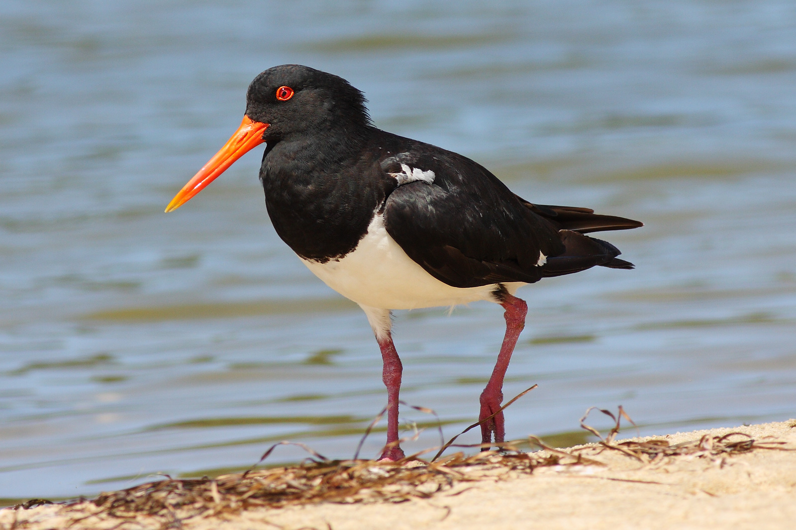
 Corner Inlet is an important site for Pied Oystercatchers
Corner Inlet is a 600 km2 bay, 200 km south-east of Melbourne, in South Gippsland, Victoria, Australia. Of Victoria’s large bays it is both the easternmost and the warmest. It contains intertidal mudflats, mangroves, salt marsh and seagrass meadows, sheltered from the surf of Bass Strait by a complex of 40 sandy barrier islands, the largest of which are Snake, Sunday and Saint Margaret Islands. It is protected as a Ramsar site, by the Nooramunga and Corner Inlet Marine and Coastal Parks, and by part of it lying within the 1550 ha Corner Inlet Marine National Park. It adjoins Wilsons Promontory in the west, extends to Ninety Mile Beach in the east, and supports large numbers of migratory waders and other birds as well a rich marine flora and fauna.[1]
Contents
History
Corner Inlet lies within the traditional lands of the Brataolong clan of the Gunai nation. In the early 1840s European settlers moved into the area and established agricultural, mining and forestry enterprises. Commercial fishing became established in the 1860s. The surrounding land was originally covered by forest which has mostly since been cleared. It has become a popular tourist destination for recreational boating and fishing.[1]
Birds
Some 720 km2 of land and water covering Corner Inlet has been recognised by BirdLife International as an Important Bird Area. Containing the most extensive intertidal mudflats in Victoria, it supports over 1% of the world populations of Chestnut Teal, Far Eastern Curlew, Red-necked Stint, Pied and Sooty Oystercatchers and the Hooded Plover. The critically endangered Orange-bellied Parrot has occasionally been seen there.[2]
References
- ^ a b Corner Inlet Marine National Park
- ^ "IBA: Corner Inlet". Birdata. Birds Australia. http://www.birdata.com.au/iba.vm. Retrieved 2011-06-16.
External links
Coordinates: 38°46′S 146°20′E / 38.767°S 146.333°E

This article about a location in Gippsland is a stub. You can help Wikipedia by expanding it.