- Cinfães Municipality
-
Cinfães — Municipality — 
Flag
Coat of armsLocation in Portugal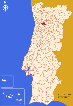
Coordinates: 41°06′N 8°08′W / 41.1°N 8.133°WCoordinates: 41°06′N 8°08′W / 41.1°N 8.133°W Country  Portugal
Region Norte Subregion Tâmega District/A.R. Viseu Government – Mayor José Manuel Pinto (PS) Area – Total 239.3 km2 (92.4 sq mi) Population – Total 21,318 – Density 89/km2 (230.5/sq mi) Parishes (no.) 17 Municipal holiday Saint John
June 24Website http://www.cm-cinfaes.pt Cinfães (Portuguese pronunciation: [sĩˈfɐ̃jʃ]) is a Portuguese village in the northern district of Viseu, with something like 3.300 inhabitants. It is also the main seat of a municipality in Portugal with a total area of 239.3 km² and a total population of 21,318 inhabitants. It's history is linked to the Knights Templar, who had strongholds in Cinfães such as "Torre da Chã" or "Torre dos Pintos"; and also the story of the childhood of King D. Afonso Henriques and his server Egas Moniz. It has an important heritage resource, especially the Romanesque churches such as St. Cristóvão de Nogueira; Lady of Cales or Cadiz, among many important others.
The municipality is composed of 17 parishes and is located in the district Viseu.The present mayor is José Manuel Pereira Pinto, elected by the Socialist Party.
The municipal holiday is June 24.
Parishes
- Alhões
- Bustelo
- Cinfães
- Espadanedo
- Ferreiros de Tendais
- Fornelos
- Gralheira
- Moimenta
- Nespereira
- Oliveira do Douro
- Ramires
- Santiago de Piães
- São Cristóvão de Nogueira
- Souselo
- Tarouquela
- Tendais
- Travanca
External links
Armamar · Carregal do Sal · Castro Daire · Cinfães · Lamego · Mangualde · Moimenta da Beira · Mortágua · Nelas · Oliveira de Frades · Penalva do Castelo · Penedono · Resende · Santa Comba Dão · São João da Pesqueira · São Pedro do Sul · Sátão · Sernancelhe · Tabuaço · Tarouca · Tondela · Vila Nova de Paiva · Viseu · Vouzela Categories:
- Municipalities of Portugal
- Towns in Portugal
- Portugal geography stubs


Wikimedia Foundation. 2010.