- Church of St Mary, Meare
-
Church of St Mary 
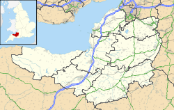
 Location within Somerset
General information Town or city Meare Country England Coordinates 51°10′18″N 2°46′44″W / 51.1718°N 2.7789°W Completed 1323 The Church of St Mary in Meare, Somerset, England was formerly in the keeping of Glastonbury Abbey, and dates from 1323. It was built for Abbot Adam of Sodbury, and is a Grade I listed building.[1]
There is a legend that the church was built on the site of a cell of the monk Saint Beonna (also Benen or Beon), who was later confused with Benignus of Armagh,[2] between the 5th and 9th centuries. His remains were removed to Glastonbury Abbey in 1091.[3][4]
The current chancel and tower date from the buildings construction in 1323 when it was consecrated by Bishop Droxford the Bishop of Bath and Wells. Around 1470 the nave was rebuilt by Abbot John Selwood and the work completed by Abbot Richard Beere. The church has a 15th century stone pulpit, wooden chest from 1705 and candelabra from 1777. The tower holds a peel of six bells.[3]
The parish is part of the benefice of Glastonbury St John the Baptist and St. Benedict with Meare, which is part of the Glastonbury deanery.[5]
See also
- List of Grade I listed buildings in Mendip
- List of towers in Somerset
References
- ^ "Church of St Mary". Images of England. http://www.imagesofengland.org.uk/details/default.aspx?id=267766. Retrieved 25 November 2011.
- ^ "Meare". Down House. http://www.downhouse.co.uk/meare.htm. Retrieved 9 october 2011.
- ^ a b "About Us — St Mary's & All Saints Church, Meare". The chu8rch of St John the Baptist, Glastonbury. http://www.stjohns-glastonbury.org.uk/stmarys.php. Retrieved 9 October 2011.
- ^ "Saint Beon (Benen) of Ireland". BridesMound. http://bridesmound.com/SaintBeon.htm. Retrieved 9 October 2011.
- ^ "The Blessed Virgin Mary & All Saints, Meare". Church of England. http://www.achurchnearyou.com/meare-the-blessed-virgin-mary-all-saints/. Retrieved 9 October 2011.
Categories:- Buildings and structures completed in 1323
- Grade I listed churches
- Grade I listed buildings in Somerset
- Church of England churches in Mendip


Wikimedia Foundation. 2010.