- Chaloem Phra Kiat District, Nan
-
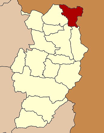
Chaloem Phra Kiat
เฉลิมพระเกียรติ— Amphoe — Amphoe location in Nan Province
Coordinates: 19°34′45″N 101°4′52″E / 19.57917°N 101.08111°ECoordinates: 19°34′45″N 101°4′52″E / 19.57917°N 101.08111°E Country  Thailand
Province Nan Amphoe established Government - Marshal Chusak Rooying Area - Total 518.690 km2 (200.3 sq mi) Population (2009) - Total 9,305 - Density 17.9/km2 (46.5/sq mi) Time zone THA (UTC+7) Postal code 55130 Geocode 5515 Chaloem Phra Kiat (Thai: เฉลิมพระเกียรติ) is a district (Amphoe) of Nan Province, northern Thailand.
Contents
History
The district was created on December 5, 1996, together with four other districts named Chaloem Phra Kiat in celebration of the 50th anniversary of King Bhumibol Adulyadej ascension to the throne.
The area of the district was created from two districts - tambon Huai Kon was previously part of Thung Chang district, while Khun Nan came from Bo Kluea district[1].
Geography
Neighboring districts are (from the south clockwise) Bo Kluea, Pua and Thung Chang. To the north and east is Xaignabouli Province of Laos with an international border crossing at Huay Kon/Muang Ngeun.
Administration
The district is subdivided into 2 subdistricts (tambon), which are further subdivided into 22 villages (muban). There are no municipal (thesaban) areas, and 2 Tambon administrative organizations (TAO).
No. Name Thai name Villages Inh. 1. Huai Kon ห้วยโก๋น 7 2,832 2. Khun Nan ขุนน่าน 15 6,328 References
- ^ "พระราชกฤษฎีกาตั้งอำเภอเฉลิมพระเกียรติ จังหวัดนครราชสีมา อำเภอเฉลิมพระเกียรติ จังหวัดนครศรีธรรมราช อำเภอเฉลิมพระเกียรติ จังหวัดน่าน อำเภอเฉลิมพระเกียรติ จังหวัดบุรีรัมย์ และอำเภอเฉลิมพระเกียรติ จังหวัดสระบุรี พ.ศ. ๒๕๓๙" (in Thai). Royal Gazette 113 (62 ก): 1–4. November 20, 1996. http://www.ratchakitcha.soc.go.th/DATA/PDF/2539/A/062/1.PDF.
External links
Mueang Nan · Mae Charim · Ban Luang · Na Noi · Pua · Tha Wang Pha · Wiang Sa · Thung Chang · Chiang Klang · Na Muen · Santi Suk · Bo Kluea · Song Khwae · Phu Phiang · Chaloem Phra Kiat
Categories:- Amphoe of Nan
- Northern Thailand geography stubs
Wikimedia Foundation. 2010.