- Bomi County
Infobox Liberia County
Fullname = Bomi County
Name = Bomi
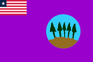
FlagSize = 100px
SealSize =
Motto =

MapSize = 300px
Languages =
Demonym =
Capital =Tubmanburg
LargestCity =
Districts =Dewoin District Klay District Mecca District Senjeh District
Area = convert|1942|km2|mi2
AreaRank = 14th
Latitude = 6° 40′ 0″ N
Longitude = 10° 15′ 0″ W
PopRank = 12th
2008Pop = 82,036
2008Density =
HighestPoint =
HighestElev =
LowestPoint =
LowestElev =
Created =
Superintendent = Haja Washington
TimeZone = GMT
TZ1Where =
TimeZone2 =
TZ2Where =
ISOCode = BM
Website =
Footnotes =
ImageSize =
Caption =Bomi is a county in the northwestern portion of the West African nation of
Liberia . One of 15 counties that comprise the first-level of administrative division in the nation, it has four districts.Tubmanburg serves as the capital with the area of the county measuring convert|1942|km2|mi2. As of the 2008 Census, it had a population of 82,036, making it the twelfth most populous county in Liberia.cite web|url=http://www.geohive.com/cntry/liberia.aspx|title=Liberia|date=2008|publisher=GeoHive|accessdate=2008-10-08] Bomi is bordered byGrand Cape Mount County to the west,Gbarpolu County to the north,Montserrado County to the southeast, and theAtlantic Ocean to the south.Districts
Bomi is divided into four districts:
*Dewoin District
*Klay District
*Mecca District
*Senjeh District Bomi has an
area of 755 sq. miles and a density of 36.6 persons per sq. mile. [ [http://www.humanitarianinfo.org/liberia/infocentre/Countyprofile/doc/Bomi%20County%20Profile%20%2030%20MAY%202005.doc Bomi County Profile] (DOC)]References
External links
* [http://www.humanitarianinfo.org/liberia/infocentre/Countyprofile/doc/Bomi%20County%20Profile%20%2030%20MAY%202005.doc Bomi County Profile] (DOC)
* [http://www.nih.gov/news/NIH-Record/08_12_97/story05.htm Voting Among the Ruins]
* [http://allafrica.com/stories/200611090734.html Liberia: Bomi County Launches "Operation Breakthrough"]
Wikimedia Foundation. 2010.