- Mount Vernon, Illinois micropolitan area
-
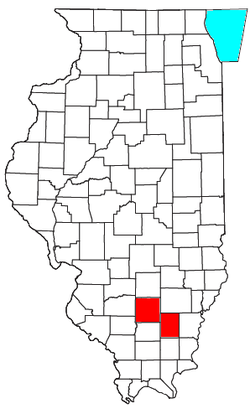 Location of the Mount Vernon Micropolitan Statistical Area in Illinois
The Mount Vernon Micropolitan Statistical Area, as defined by the United States Census Bureau, is an area consisting of two counties in southern Illinois, anchored by the city of Mount Vernon.
As of the 2000 census, the μSA had a population of 48,666 (though a July 1, 2009 estimate placed the population at 48,040).[1]
Contents
Counties
Communities
- Places with more than 10,000 inhabitants
- Centralia (partial)
- Mount Vernon (Principal city)
- Places with 1,000 to 5,000 inhabitants
- Places with less than 500 inhabitants
- Unincorporated places Hamilton County
- Aden
- Blairsville (Flannigan's Store)
- Braden
- Bungay
- Delafield
- Diamond City
- Feakeyville
- Flint (ghost town)
- Garrison
- Hoodville
- Jefferson City, IL (ghost town near Bungay)
- Logansport, IL
- Lovilla (ghost town, see Dahlgren)
- Olga
- Piopolis (New Bremen)
- Rectorville (moved to/became Broughton)
- Slapout (ghost town)
- Thackeray
- Thurber
- Tucker's Corner
- Walpole
Townships
Hamilton County
Jefferson County
Demographics
As of the census[2] of 2000, there were 48,666 people, 18,836 households, and 12,998 families residing within the μSA. The racial makeup of the μSA was 91.36% White, 6.56% African American, 0.22% Native American, 0.41% Asian, 0.01% Pacific Islander, 0.39% from other races, and 1.05% from two or more races. Hispanic or Latino of any race were 1.20% of the population.
The median income for a household in the μSA was $32,026, and the median income for a family was $39,396. Males had a median income of $32,977 versus $19,496 for females. The per capita income for the μSA was $16,453.
See also
References
- ^ "Table 1. Annual Estimates of the Population of Metropolitan and Micropolitan Statistical Areas: April 1, 2000 to July 1, 2009 (CBSA-EST2009-01)" (CSV). 2009 Population Estimates. United States Census Bureau, Population Division. 2010-03-23. http://www.census.gov/popest/metro/tables/2009/CBSA-EST2009-01.csv. Retrieved 2010-03-25.
- ^ "American FactFinder". United States Census Bureau. http://factfinder.census.gov. Retrieved 2008-01-31.
- Places with more than 10,000 inhabitants

Wikimedia Foundation. 2010.