- Chakaten
-
Chakaten
Ճակատեն— community — 
 Chakaten
Coordinates: 39°08′40″N 46°26′25″E / 39.14444°N 46.44028°ECoordinates: 39°08′40″N 46°26′25″E / 39.14444°N 46.44028°E Country  Armenia
Marz (Province) Syunik Area[1] - Total 14.25 km2 (5.5 sq mi) Population (2010) - Total 137 - Density 9.6/km2 (24.9/sq mi) Time zone (UTC+4) - Summer (DST) (UTC+5) Chakaten at GEOnet Names Server Chakaten (Armenian: Ճակատեն, also Romanized as Jakaten and Chakidyn) is a village and rural community (municipality) in the Syunik Province of Armenia. The National Statistical Service of the Republic of Armenia (ARMSTAT) reported its population as 137 in 2010,[2] down from 190 at the 2001 census.[3]
References
- ^ (Armenian) "Syunik regional e-Governance System". Syunik provincial government. http://Syunik.region.am. Click on link entitled "Համայնքներ" (community) and search for the place by Armenian name.
- ^ "Marzes of the Republic of Armenia and Yerevan City in Figures, 2010". National Statistical Service of the Republic of Armenia (ARMSTAT). http://www.armstat.am/file/article/marz_10_44.pdf.
- ^ Report of the results of the 2001 Armenian Census, National Statistical Service of the Republic of Armenia
Capital: Kapan Goris 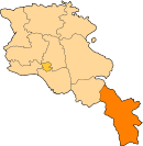
Kapan Agarak · Aghvani · Antarashat · Arajadzor · Artsvanik · Atchanan · Chakaten · Chapni · David Bek · Dzorastan · Egheg · Eghvard · Geghanush · Geghi · Kaghnut · Kapan · Khdrants · Lernadzor · Nerqin Hand · Nerqin Khotanan · Nor Astghaberd · Norashenik · Okhtar · Qajaran · Qajaran · Sevaqar · Shikahogh · Shrvenants · Srashen · Syunik · Tandzaver · Tavrus · Tsav · Uzhanis · Vanek · Vardavanq · Verin KhotananSisian Aghitu · Akhlatyan · Angeghakot · Arevis · Ashotavan · Balak · Bnunis · Brnakot · Darbas · Dastakert · Getatagh · Gorayk · Hatsavan · Ishkhanasar · Lor · Ltsen · Mutsk · Njdeh · Noravan · Salvard · Sarnakunk · Shaghat · Shaki · Shenatagh · Sisian · Spandaryan · Tanahat · Tasik · Tolors · Torunik · Tsghuk · Uyts · Vaghatin · VorotanMeghri Categories:- Communities in Syunik
- Populated places in Syunik
- Syunik geography stubs


Wikimedia Foundation. 2010.