Majosháza

Majosháza
Majosháza
File:Majosháza címere.jpg
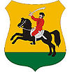
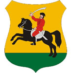
Coat of arms
Majosháza is located in Hungary
Majosháza
Location of Majosháza in Hungary
Coordinates: 47°15′45″N 19°00′06″E / 47.26238°N 19.00153°E / 47.26238; 19.00153
Country Hungary
Region Central Hungary
County Pest
Subregion Ráckevei
Rank Village
KSH code 10755[1]
Area[1]
 – Total 11.42 km2 (4.4 sq mi)
Population (1 January 2008)[1]
 – Total 1,416
 – Density 124/km2 (321.1/sq mi)
Time zone CET (UTC+1)
 – Summer (DST) CEST (UTC+2)
Postal code 2339
Area code +36 24
Website www.majoshaza.hu

Majosháza is a village in Pest county, Budapest metropolitan area, Hungary. It has a population of 1,365 (2007).


References

  1. ^ a b c Majosháza at the Hungarian Central Statistical Office (Hungarian). 1 January 2008

Coordinates: 47°16′N 19°00′E / 47.267°N 19°E / 47.267; 19


Wikimedia Foundation. 2010.

Игры ⚽ Поможем написать курсовую

Look at other dictionaries:

  • Majosháza — Administration …   Wikipédia en Français

  • Pest County — Infobox Hungarian county name =Pest region =Central Hungary seat = Budapest area = 6394 population = 1,077,300 density = 168 cities = 186Pest County (IPA2|pɛʃt) is a county ( megye ) in central Hungary. It covers an area of 6394 km², and has a… …   Wikipedia

  • Örkény — If you are looking for István Örkény, the writer, click the link. Örkény Aerialphotography: Örkény, palace …   Wikipedia

  • Dabas, Hungary — Dabas Dabas church from the air …   Wikipedia

  • Monor — For the commune in Bistriţa Năsăud County, Romania, see Monor, Bistriţa Năsăud. Monor Aerial photograph of Monor …   Wikipedia

  • Nagymaros — Aerial view …   Wikipedia

  • Dunakeszi —   City   …   Wikipedia

  • Nagykőrös — Nagykőrös …   Wikipedia

  • Százhalombatta — Százhalombatta …   Wikipedia

  • Dunaharaszti — Dunaharaszti …   Wikipedia

Share the article and excerpts

Direct link
Do a right-click on the link above
and select “Copy Link”