- Comer's Midden
-
Comer's Midden Created Thule culture Discovered 1916 Present location Near Pituffik, Greenland 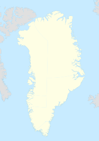
 Comer's MiddenLocation within Greenland
Comer's Midden is a 1916 archaeological excavation site near the "Arctic Station of Thule" (also called Qaanaaq), north of Mt. Dundas (near Pituffik), in North Star Bay, northern Greenland.[1][2][3] It is the find after which the Thule culture is named.[4] The site was first excavated in 1916 by whaling Captain George Comer, ice master of the Crocker Land Expedition's relief team, and members of Knud Rasmussen's Second Danish Thule Expedition who were in the area charting the North Greenland coast.[5][6]
Contents
Excavation phases
- 1916
With his ship ice-bound, Comer made use of his time through an archaeological excavation just south of Arctic Station of Thule unearthing, amongst other things, a kitchen-midden made by paleo-Eskimos.[3] The site is named in honor of Comer and the midden that he found.[7][8][9]
- 1920s
Anthropologist Therkel Mathiassen accompanied Rasmussen's 5th Thule Expedition (1921—1924) that included a return to the Thule site. In Mathiasen's monumental[10] works of the 1920s and 1930s, he described Comer's Midden as "the only substantial find of pure Thule culture in Greenland".[11]
- 1930s and 1940s
The site was excavated by Erik Holtved in 1935 to 1937, and again in 1946 to 1947.[12][13]
Archaeological finds
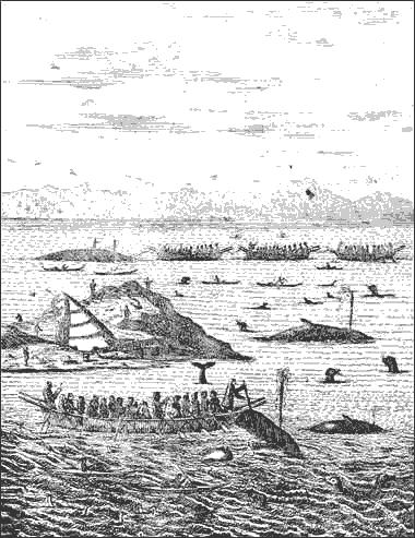
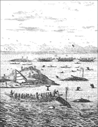 Thule Greenlanders whaling, drawing by Hans Egede, 18th century
- Habitation periods
The site shows signs of having been inhabited from the 14th to the 20th century although Holtved reports that the 17th and 18th centuries are poorly represented.[14]
- Ruins
The site contains about 26 house ruins and several middens distributed over an area of about 120 m in width and stretching over 400 m inland with the midden Comer excavated located at its south end.[15] The majority of the houses were more or less rounded, typically around 3m to 5m across and most likely residential. One house was rectangular 4.5m by 6m, with narrow platforms along two of the walls, was probably a "qassi" or "mens' house" and was probably used as a workshop and for social gatherings.[16][17]
- Artifacts
Subsequent to the initial finds, additional artifacts pertain to the Dorset culture,[18][19] as well as items of Norse origin.[20]
The vast majority of harpoon heads found are of the open socket type typical of the Thule culture.
Re-settlement
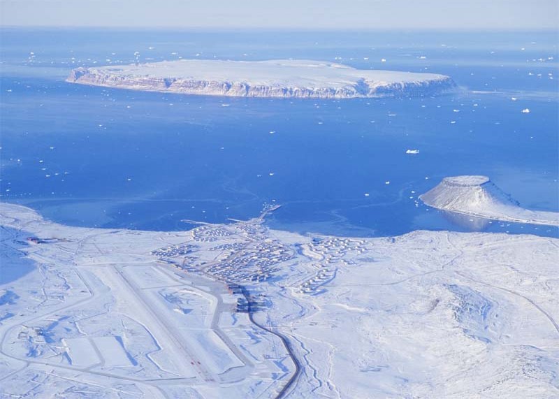
 Thule Air Base, 2005
In 1910, Rasmussen and Peter Freuchen established a private trading post (Cape York station) at Thule (Greenlandic, Uummannaq), and a settlement area was established near it by local North Greenlandic Inuit.[3] In 1953, Uummannaq was converted into Thule Air Force Base, and Uummannaq's residents were relocated to Qaanaaq.
Notes
- ^ Thalbitzer, 1934
- ^ Dick, 2001
- ^ a b c Thule Forum, 2006
- ^ Birket-Smith, p. 548.
- ^ Wissler, p. 111.
- ^ Rasmussen, p. 117.
- ^ Ross, 1984
- ^ "With the aid of Captain Comer, of the Crocker Land Expedition, a large kitchen-midden was dug out in Umanaq". http://www.google.com/search?hl=en&client=firefox-a&rls=org.mozilla%3Aen-US%3Aofficial&hs=CSk&q=With+the+aid+of+Captain+Comer%2C+of+the+Crocker+Land+Expedition%2C+a+large+kitchen-midden+was+dug+out+in+Umanaq.+At+the+bottom+of+this+was+uncovered+a+layer+of&btnG=Search. Retrieved 2008-03-31.
- ^ "In the Cape York district the find from Comer's Midden is the datum.". http://www.google.com/search?hl=en&client=firefox-a&rls=org.mozilla%3Aen-US%3Aofficial&q=In+the+Cape+York+district+the+find+from+Comer%27s+Midden+is+the+datum.+Of+the+archeology+of+the+Angmagssalik+district+of+the+southeast+absolutely+nothing+is&btnG=Search. Retrieved 2008-03-31.
- ^ Meldgaard, p. 9.
- ^ Mathiassen, p. 409.
- ^ Holtved (1944), vol. I, p. 8.
- ^ Holtved (1954), p. 5.
- ^ Holtved (1944) vol. II, p. 179.
- ^ Holtved (1944), vol. I, p. 110–12.
- ^ Holtved (1944), vol. I, pp. 128–30.
- ^ Gulløv, pp. 288–90.
- ^ Holtved (1944), vol. II, p. 10.
- ^ Holtved (1954), pp. 107–13.
- ^ Holtved (1944), vol. II, p. 26.
References
- "A short history of Dundas and the Thule District". thuleforum.com. 2006-02-28. http://www.thuleforum.com/jette/greenl1-5.html. Retrieved 2008-05-03.
- Birket-Smith, Kaj (1925). "Physical Anthropology, Linguistics, and Material Culture" in Rasmussen, Knud; Birket-Smith, Kaj; Mathiassen, Therkel; Freuchen, Peter The Danish Ethnographic and Geographic Expedition to Arctic America. Preliminary Report of the Fifth Thule Expedition. Geographical Review, vol. 15, no. 4, pp. 535–49. American Geographical Society.
- Dick, Lyle (2001). Muskox Land: Ellesmere Island in the Age of Contact. Calgary: University of Calgary Press. pp. 343. ISBN 1552380505. http://books.google.com/?id=seWk7ZVSE7sC&pg=PA343&lpg=PA343&dq=comer+rasmussen+thule+1916.
- Gulløv, Hans Christian (2004). "Nunarput, vort land. Thulekulturen." (Danish) in Gulløv, Hans Christian (ed.) Grønlands forhistorie. Gyldendal. ISBN 87-02-01724-5.
- Holtved, Erik (1944). Archaeological Investigations in the Thule District, vol I. Descriptive part. Meddelelser om Grønland, vol. 141, no. 1. Copenhagen: C. A. Reitzel.
- Holtved, Erik (1944). Archaeological Investigations in the Thule District, vol II. Analytical part. Meddelelser om Grønland, vol. 141, no. 2. Copenhagen: C. A. Reitzel.
- Holtved, Erik (1954). Archaeological Investigations in the Thule District, vol III. Nûgdlît and Comer's Midden. Meddelelser om Grønland, vol. 146, no. 3. Copenhagen: C. A. Reitzel.
- Mathiassen, Therkel (1935). Eskimo Migrations in Greenland. Geographical Review, vol. 25, no. 3, pp. 408–22. American Geographical Society.
- Meldgaard, Jørgen (1996). "The Pioneers: The Beginnings of Paleo-Eskimo Research in West Greenland" in Grønnow, Bjarne; Pind, John (eds.) The Paleo-Eskimo Cultures of Greenland — New Perspectives in Greenlandic Archaeology. Copenhagen: Danish Polar Center. ISBN 87-90369-02-5.
- Rasmussen, Knud (1919). The Second Thule Expedition to Northern Greenland, 1916–1918. Geographical Review, vol. 8, no. 2, pp. 116–25. American Geographical Society.
- Ross, W. Gillies (1984). An Arctic whaling diary : the journal of captain George Comer in Hudson Bay, 1903-1905. Toronto: University of Toronto Press. ISBN 0802056180. http://www.biblioz.com/lp25762147194_74.html.
- Thalbitzer, William (October-November, 1934). "Knud Rasmussen: In Memoriam". American Anthropologist (publicanthropology.org) 36 (4): 585–594. doi:10.1525/aa.1934.36.4.02a00080. http://www.publicanthropology.org/Archive/Aa1934.htm.
- Wissler, Clark (1918). Archaeology of the Polar Eskimo. Anthropological Papers of the American Museum of Natural History, vol. 22, part 3, pp. 105–66.
Coordinates: 76°34′N 68°50′W / 76.567°N 68.833°W
Abandoned sites in Greenland Inuit QaasuitsupAnnoatok • Appaalissiorfik • Ataa • Comer's Midden • Etah • Ikermiut • Illulik • Itissaalik • Kuuk • Narsaarsuk • Pituffik • Qernertuarssuit • Qilakitsoq • Qullissat • Saattoq • Sarfaq
Norse (Vestribyggð)Polar Exploration and Research Categories:- Populated places established in the 14th century
- Archaeological sites in Greenland
- Inuit history
- Prehistory of the Arctic
- Former populated places in Greenland

Wikimedia Foundation. 2010.