- Marsland, Nebraska
-
Marsland, Nebraska — Unincorporated community — Location within the state of Nebraska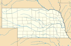
 Marsland, Nebraska
Coordinates: 42°26′38″N 103°17′55″W / 42.44389°N 103.29861°WCoordinates: 42°26′38″N 103°17′55″W / 42.44389°N 103.29861°W Country United States State Nebraska County Dawes Elevation 4,160 ft (1,268 m) Time zone Central (CST) (UTC-6) - Summer (DST) CDT (UTC-5) ZIP codes 69354 FIPS code GNIS feature ID 831064 Marsland is an unincorporated community in southwestern Dawes County, Nebraska, United States. It lies on the Niobrara River along Nebraska Highways 2 and 71, southwest of the city of Chadron, the county seat of Dawes County.[1] Its elevation is 4,160 feet (1,298 m).[2] Although Marsland is unincorporated, it has a post office, with the ZIP code of 69354.[3]
References
- ^ Rand McNally. The Road Atlas '08. Chicago: Rand McNally, 2008, p. 62.
- ^ U.S. Geological Survey Geographic Names Information System: Marsland, Nebraska, Geographic Names Information System, 1979-03-09. Accessed 2008-04-26.
- ^ Zip Code Lookup
Municipalities and communities of Dawes County, Nebraska County seat: Chadron Cities 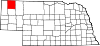
Village Unincorporated
communityMarsland
Categories:- Populated places in Dawes County, Nebraska
- Unincorporated communities in Nebraska
- Nebraska geography stubs

Wikimedia Foundation. 2010.