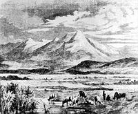
- Breadfield
-
The Breadfield (Romanian: Câmpul Pâinii, Hungarian: Kenyérmező) is a region in southwest Transylvania (Romania), between Orăştie (Szászváros) and Sebeş (Szászsebes) in the Transylvanian Saxon land, near the Mureş River. The central settlement is Cugir (Hungarian: Kudzsir, German: Kudschir).
The Cugir Creek's old Magyar name is Kenyér (bread), which gave rise to the name Breadfield. The region's borders to the south are the Cugir Mountains, to the north the Mureş, to the west Hunedoara County, and to the east the Sebeş River.
The area is a fertile plain. Formerly, Breadfield's population was largely Saxons, but today it is chiefly Romanians. In 1479 the Transylvanians scored a victory over the Ottoman Army in the Breadfield (near Şibot). In remembrance of the victory Stephen V Báthory built a chapel.
- Settlements of Breadfield
- Vinţu de Jos (hung. Alvinc, ger. Unterwintz or Winzendorf)
- Pianul de Jos (hung. Alsópián, Szászpián, Romanian Chian, ger. Deutschpien or Deutschpian)
- Săliştea, Alba (hung. Tartaria, later Alsótatárlaka,, in 1310 Oláhárkos and Szászárkos or -erkes, in 1488 Grebencsin)
- Săliştea (a different town from the above mentioned settlement; sometime Cioara, hung. Alsócsóra)
- Balomiru de Câmp (hung. Balomir)
- Şibot (hung. Alkenyér or Zsibotalkenyér, ger. Unterbrodsdorf)
- Vinerea (hung. Felkenyér, ger. Oberbrodsdorf)
- Cugir
- Aurel Vlaicu (previoisly Binţinţi, hung. Bencenc, ger. Benzendorf. the location of the Breadfield Battle)
- Pişchinţi (hung. Piskinc)
- Vaidei (hung. Vajdej, ger. Weidendorf)
- Romos (hung. Romosz, ger. Rumes)
- Gelmar (hung. Gyalmár)
See also
External links
- (Hungarian) Reminiscences of the Breadfield
- Small lexicon - Breadfield (Hungarian)
- Hungarian Ethnical Lexicon (Hungarian)
Coordinates: 45°55′42″N 23°19′44″E / 45.92833°N 23.32889°E
Categories:- Geography of Romania
- Geography of Transylvania
- History of Transylvania
- Geography of Hungary
Wikimedia Foundation. 2010.

