- Träslövsläge
Infobox Settlement
official_name = Träslövsläge
image_dot_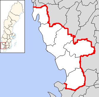
dot_mapsize = 210px
dot_map_caption = Location of Träslövsläge inHalland
dot_x =88 |dot_y =80
map_caption = Träslövsläge
subdivision_type = Country
subdivision_type1 = Province
subdivision_type2 = Municipality
subdivision_name =Sweden
subdivision_name1 =Halland
subdivision_name2 =Varberg
area =Halland
county =Hallands län
overigniveau = Varberg
population_total = 1985
population_as_of= 2005
area_total_km2 = 1.34
latd =57
latm =3
lats =
latNS = N
longd =12
longm =16
longs = 0
longEW = ETräslövsläge is an locality in
Varberg Municipality ,Halland County on the Swedish west coast. Träslövsläge had 1.985 inhabitants in 2005 and covers an area of 134hectare .Träslövsläge has a fishing harbour. Due to harbour expansion during the 20th century, this harbour has become the largest fishing harbour in Halland County.
A part of the early settlements still exists along the narrow "Storgatan." Träslövsläge has grown southwards and eastwards.
Next to the fishing harbour lies a well-equipped marina. The marina has a petrol station and a restaurant. Träslövsläge has excellent conditions for
windsurfing . Especially when the winds come from the southwest. The name Träslövsläge means Träslöv’s harbour.The dialect "Läjesboa" is still being spoken by a few people in Träslövsläge. In
Denmark it is regarded as a Danish dialect Fact|date=April 2008. "Läjesboa" is a remainder from the time before Swedishculture began to influence Halland County. Halland came under Swedish rule during the end of the 17thcentury .History
The first time this fishing
village was mentioned was in 1558 – 1559. Back then it had the name "Tøllen". Two fishing teams consisting of seven men in total fished from "Tøllen". Aland reform was held in1833 . Its purpose was to give everyfarmer coherent peaces ofland . This land reform emcompassed every village in thecountry . Until Träslövsläge got a properharbour of its own, the boats were anchored to the islets "Rödskär" and "Svartskär". "Rödskär och Svartskär" means RedIslet and Black Islet in Swedish.They started to build the harbour between 1876 - 1880. A harbour
pier was built and a harbourdepth of 5 – 6 feet was established. But this harbour only served its purpose partly. Between 1913-1922 a more significant harbour was built. Thereafter the harbour has been improved and has been rebuilt on a number of occasions.Source
* Träslövs hembygdsförening (1971). Träslövsboken. Träslövs hembygdsförening.
Wikimedia Foundation. 2010.