- Christopher Saxton
-
Christopher Saxton was an English cartographer, probably born in the parish of Dewsbury, in the West Riding of Yorkshire, England around 1540.
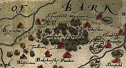
Saxton grew up in the hamlet of Dunningley, near Tingley in the parish of Whitkirk. As a young man he was employed as a servant of John Rudd, the vicar of Dewsbury and Thornhill, a keen cartographer who passed his skills to Saxton. In 1570 Saxton began a survey of the whole of England and Wales on the commission of Lord Burghley. This was a significant undertaking at the time, and yet by 1574 the first plates had been engraved and in 1578 the survey was complete. The maps produced set the standard for cartographers to follow, and base their own maps on.
He died around 1610.
References
- Christopher Saxton, William Ravenhill (introduction), Christopher Saxton's 16th Century Maps, Chatsworth Library ISBN 1-85310-354-3 (hbk, 1992) ISBN 1-85310-724-7 (pbk, 1995).
External links
Categories:- 1540 births
- 1610 deaths
- English cartographers
- People from Dewsbury
- People of the Tudor period
- People of the Stuart period
- 16th-century English people
- 17th-century English people
Wikimedia Foundation. 2010.

