Sibrandabuorren — 53°4′6″N 5°43′16″E / 53.06833, 5.72111 … Wikipédia en Français
Sijbrandaburen — Sibrandabuorren 53°4′6″N 5°43′16″E / 53.06833, 5.72111 … Wikipédia en Français
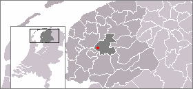
Boarnsterhim — Infobox Settlement official name = Boarnsterhim image seal size = 70px mapsize = 280px subdivision type = Country subdivision name = Netherlands subdivision type1 = Province subdivision name1 = Friesland area footnotes = (2006) area total km2 =… … Wikipedia
Boarnsterhim — Gemeinde Boarnsterhim Flagge Wappen Provinz Friesland … Deutsch Wikipedia
Boornsterhem — Gemeinde Boarnsterhim Flagge Wappen Provinz … Deutsch Wikipedia
Aegum — Eagum Eagum Vue de la localité sur la carte des Pays Bas Pays Pays Bas … Wikipédia en Français
Akkrum — 53°2′56″N 5°50′8″E / 53.04889, 5.83556 … Wikipédia en Français
Aldeboarn — 53° 02′ 00″ N 5° 53′ 00″ E / 53.0333, 5.88333 … Wikipédia en Français
Boarnsterhim — Héraldique … Wikipédia en Français
Boornsterhem — Boarnsterhim Boarnsterhim … Wikipédia en Français