- Stewardson Township, Pennsylvania
Infobox Settlement
official_name = Stewardson Township, Pennsylvania
other_name =
native_name =
nickname =
settlement_type = Township
motto =
imagesize =
image_caption = Kettle Creek passes throughOle Bull State Park in Stewardson Township.
flag_size =
image_
seal_size =
image_shield =
shield_size =
city_logo =
citylogo_size =
mapsize = 250x200px
map_caption = Map of Potter County, Pennsylvania highlighting Stewardson Township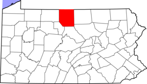
mapsize1 = 250x200px
map_caption1 = Map of Potter County, Pennsylvania
subdivision_type = Country
subdivision_name =United States
subdivision_type1 = State
subdivision_name1 =Pennsylvania
subdivision_type2 = County
subdivision_name2 = Potter
subdivision_type3 =
subdivision_name3 =
subdivision_type4 =
subdivision_name4 =
government_footnotes =
government_type =
leader_title =
leader_name =
leader_title1 =
leader_name1 =
leader_title2 =
leader_name2 =
leader_title3 =
leader_name3 =
leader_title4 =
leader_name4 =
established_title = Settled
established_date = 1852
established_title2 = Incorporated
established_date2 = 1856
area_magnitude =
unit_pref = Imperial
area_footnotes =
area_total_km2 = 192.5
area_land_km2 =
area_water_km2 =
area_total_sq_mi = 74.3
area_land_sq_mi =
area_water_sq_mi =
area_water_percent =
population_as_of = 2000
population_footnotes =
population_note =
population_total = 74
population_density_km2 = 0.4
population_density_sq_mi = 1.0
timezone = EST
utc_offset = -5
timezone_DST = EDT
utc_offset_DST = -4
elevation_m =
elevation_ft =
postal_code_type =
postal_code =
area_code =
website =
footnotes =Stewardson Township is a township in Potter County,
Pennsylvania ,United States . The population was 74 at the 2000 census.Ole Bull State Park a Pennsylvania state park is in Stewardson Township.Geography
According to the
United States Census Bureau , the township has a total area of 74.3square mile s (192.5km² ), all of it land.Stewardson Township is bordered by Abbott Township to the north, Tioga and Lycoming Counties to the east, Clinton County to the south and East Fork Township to the west.
Demographics
As of the
census GR|2 of 2000, there were 74 people, 39 households, and 20 families residing in the township. Thepopulation density was 1.0 people per square mile (0.4/km²). There were 334 housing units at an average density of 4.5/sq mi (1.7/km²). The racial makeup of the township was 98.65% White, and 1.35% from two or more races.There were 39 households out of which 15.4% had children under the age of 18 living with them, 43.6% were married couples living together, 5.1% had a female householder with no husband present, and 46.2% were non-families. 35.9% of all households were made up of individuals and 17.9% had someone living alone who was 65 years of age or older. The average household size was 1.90 and the average family size was 2.43.
In the township the population was spread out with 13.5% under the age of 18, 4.1% from 18 to 24, 27.0% from 25 to 44, 29.7% from 45 to 64, and 25.7% who were 65 years of age or older. The median age was 47 years. For every 100 females there were 80.5 males. For every 100 females age 18 and over, there were 93.9 males.
The median income for a household in the township was $21,250, and the median income for a family was $28,125. Males had a median income of $25,625 versus $28,750 for females. The
per capita income for the township was $12,235. There were 11.8% of families and 15.8% of the population living below thepoverty line , including 28.6% of under eighteens and none of those over 64.References

Wikimedia Foundation. 2010.