- Mangawhai
-
Mangawhai 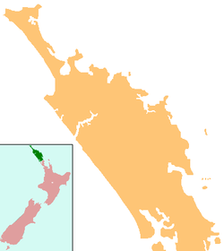
 Mangawhai
Coordinates: 36°7′35″S 174°34′29″E / 36.12639°S 174.57472°ECoordinates: 36°7′35″S 174°34′29″E / 36.12639°S 174.57472°E Country New Zealand Region Northland Region District Kaipara District Population (2006) - Total 1,665 Mangawhai is a locality in Northland, New Zealand around the Mangawhai Harbour. The township of Mangawhai is at the south west extent of the harbour, and the township of Mangawhai Heads is 5 km north east. Kaiwaka is 13 km south west, and Waipu is 20 km north west of Mangawhai Heads.[1][2]
The population for the Mangawhai statistical district was 813 in the 2006 Census, an increase of 189 from 2001. The statistical district covers a significantly larger area than the township.[3] The population for Mangawhai Heads was 852 in 2006, up 132 from 2001.[4]
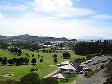 View from an observation tower
Contents
History
In the early and mid 19th century, Mangawhai Harbour was one of the main access points for the Kaipara. Ngāti Whātua used to drag waka from Kaiwaka to Mangawhai.[5] A Ngā Puhi war party landed at Mangawhai in February 1825 (memorial plinth, Mangawhai Museum and all publications regarding Mangawhai early history) and moved 12 km inland to confront the Ngāti Whātua at Te Ika-a-ranga-nui near Kaiwaka.[6][7]
Later in the 19th century, settlers would travel by boat from Auckland to Mangawhai, walk to Kaiwaka, and then travel on the water again across the Kaipara Harbour. By the early 1860s, a dray road existed between Mangawhai and Kaiwaka.[8]
Sand mining
Sand mining began at the Mangawhai Harbour entrance pre 1940 (Eye witness accounts by all that resided at Mangawhai).[9] In 1978 the collapse of sand dunes closed the harbour, and it took five and a half years before it was reopened.[10] The Mangawhai Harbour Restoration Society believes the sand mining caused the collapse.[9][11]
From 1993 to 2004, sand was commercially suction-dredged from the sandbars of Mangawhai Heads.[12][13] In 2004, the Mangawhai Harbour Restoration Society won an Environment Court decision to stop the issue of new licences.[11] The companies such as McCallum Brothers, re-applied to the Auckland Regional Council for resource consent but the application was turned down in 2005.[14]
An application to sand mine in the Mangawhai Forest is currently[update] being heard by the Environment Court.[15]
Education
Mangawhai Beach School is a coeducational full primary (years 1-8) school with a decile rating of 6 and a roll of 285.[16]
References
- ^ Peter Dowling (editor) (2004). Reed New Zealand Atlas. Reed Books. pp. map 8. ISBN 0-7900-0952-8.
- ^ Roger Smith, GeographX (2005). The Geographic Atlas of New Zealand. Robbie Burton. pp. map 31. ISBN 1-877333-20-4.
- ^ Quickstats about Mangawhai
- ^ Quickstats about Mangawhai Heads
- ^ "Unknown title". The Journal of the Polynesian Society (Polynesian Society) 10: 30. 1901. http://books.google.com/?id=1pyLSQOwTbQC&q=Mangawhai&dq=Mangawhai.
- ^ Byrne, Brian (2002). The Unknown Kaipara. Auckland, N.Z.: T.B. Byrne. pp. 25. ISBN 0-473-08831-2.
- ^ Stone, Russell (2001). From Tamaki-Makau-Rau to Auckland. pp. 100. ISBN 9781869402594. http://books.google.com/?id=5RVnVeGiCzAC&pg=PA100&dq=Kaiwaka.
- ^ Ryburn, Wayne (1999). Tall Spars, Steamers & Gum. Auckland, N.Z.: Kaipara Publications. pp. 16–17, 30, 38. ISBN 0-473-06176-7.
- ^ a b "Mangawhai Harbour entrance". Te Ara Encyclopedia of New Zealand. http://www.teara.govt.nz/EarthSeaAndSky/MineralResources/RockLimestoneAndClay/3/ENZ-Resources/Standard/5/en.
- ^ They Dared the Impossible. 2007.
- ^ a b "Community saves coast". ASB Community Trust. http://www.asbcommunitytrust.org.nz/Case-environment-Mangawhai.html.
- ^ "Phosphates, ironsands and sands". Te Ara Encyclopedia of New Zealand. http://www.teara.govt.nz/EarthSeaAndSky/MineralResources/MarineMinerals/2/en.
- ^ "Auckland's Northeast Coast Under Attack". Deep Fried TV. 29 October 2004. http://www.deepfried.tv/news/default.cfm?ID=402&Pg=1090.
- ^ Pryce, Michael (June 2005). "Nautical News: Mangawhai Harbour Sand Minng Ban". New Zealand Marine News 53 (2): 98–99. http://nzmaritimeindex.org.nz/ixref.asp?refid=53020050&hit=-1.
- ^ "Sand mining likely at Mangawhai Forest". Rodney Times. 29 January 2008. Archived from the original on 2008-02-26. http://www.webcitation.org/5VsoqBuLe.
- ^ "Te Kete Ipurangi - Mangawhai Beach School". Ministry of Education. http://www.tki.org.nz/e/schools/display_school_info.php?school_id=1038.
External links
Categories:- Kaipara District
- Populated places in New Zealand


Wikimedia Foundation. 2010.