- Lyø
Geobox Settlement
name = Lyø Island
native_name =
other_name =
other_name1 =
category = Island
image_size = 290px
image_caption =
flag_size =
symbol =
symbol_size = 90px
country = Denmark | state=
region =
district =Svendborg municipality
district_type = Municipality | district_label=
part_type = | part_count =
part = | part1 =
area = 6
area_round = 0
location =
lat_d = 55 | lat_m = 2 | lat_s = 0 | lat_NS= N
long_d= 10 | long_m= 10 | long_s= 0 | long_EW= E
elevation =
population_as_of = 2005
population = 140 | population_density=
established_type =
established =
established1_type =
mayor =
timezone = CET
utc_offset = +1
timezone_DST = CEST
utc_offset_DST= +2
postal_code = | postal_code_type = Postal codes
area_code = | area_code_type=
free_type = | free=
free1_type = | free1=
 map_size=
map_caption = Drejø is north of Ærø (bottom left)
map_locator =
map_locator_x = 30.4
map_locator_y = 82.4
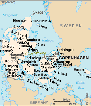
website =Lyø is a Danish island south of
Funen . The island covers an area of 6 km² (2 square miles) and has 140 inhabitants. The island can be reached byferry fromFaaborg andAvernakø .[
 Lyø island (lower left) is north of
 Ærø , south of Funen Island & northwest ofDrejø .]
Wikimedia Foundation. 2010.