- Şurgani River
Geobox River
name = Şurgani River
native_name =
other_name = (Şorcan River)
other_name1 =

image_size = 300
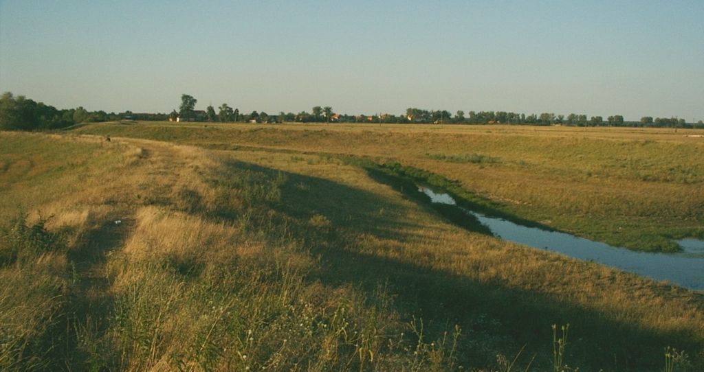
image_caption = The Şurgani river upstream of the village of Chevereşu Mare
country_type = Countries
state_type =
region_type =
district_type = Counties
city_type = Villages
country =Romania
country1 =
state =
state1 =
region =
region1 =
district =Timiş County
district1 =
city =
city1 =
length = 31
watershed =
discharge_location =
discharge =
discharge_max =
discharge_min =
discharge1_location =
discharge1 =
source_name = Dumbrava Forest
source_location =
source_district =
source_region =
source_state =
source_country =
source_lat_d =
source_lat_m =
source_lat_s =
source_lat_NS =
source_long_d =
source_long_m =
source_long_s =
source_long_EW =
source_elevation =
source_length =
mouth_name =Timiş
mouth_location = Dragşina
mouth_district =
mouth_region =
mouth_state =
mouth_country =
mouth_lat_d =
mouth_lat_m =
mouth_lat_s =
mouth_lat_NS =
mouth_long_d =
mouth_long_m =
mouth_long_s =
mouth_long_EW =
mouth_elevation =
tributary_left = Făgimac,
Silagiu,
Vucova
tributary_left1 =
tributary_right = Salcia,
Vâna
tributary_right1 =
free =
free_type = Official River Code
map_size =
map_caption =The Şurgani River (locally also called Şorcan River) is a
tributary of the Timiş River inRomania .Hidrography
The Şurgani river originates in
Dumbrava Forest , east of the city ofBuziaş . It crosses the central part of the Banat plain and, after crossing the village of Chevereşu Mare it joins the Timiş River south of the village of DracşinaThe main tributaries of the Şurgani river are: the Salcia, Făgimac, Silagiu and Vucova rivers. The
Vâna River , at present a tributary of the Şurgani River, is a former branch of the Şurgani, whose upstream link to the river has been cut of by the embankment.Development
There are two storage lakes located on the Salcia River and the Silagiu in the upper basin of the Şurgani River.
At the beginning of the XX-th century, dykes have been built along the lower reach of the river, from the village of Chevereşu Mare to the junction with the Timiş River.
Environmental problems
The Şurgani Rivers is a vector for the expansion of the indigo bush (
Amorpha fructicosa), an invasive plant originary from North America, which was brought to the Buziaş area for decorative purposes. The bush has invaded the banks of the Şurgani River and of the Timiş River downstream of the confluence with the Şurgani River, gradually replacing the autochthonous vegetation.References
* Administraţia Naţională Apelor Române - Cadastrul Apelor - Bucureşti
* Institutul de Meteorologie şi Hidrologie - Rîurile României - Bucureşti 1971
* Simuţ, Doru O., Simuţ, Lenuţa - "Buziaş", Bucureşti, ed. Sport-Turism, 1986Maps
* Harta judeţului Timiş [http://www.harta-turistica.ro/map.php?ID=39&harta=Judetul%20Timis]
Wikimedia Foundation. 2010.
