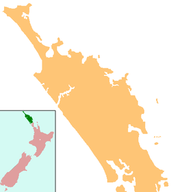
Oruaiti

Oruaiti
Oruaiti
Oruaiti is located in Northland
Oruaiti
Coordinates: 35°0′12″S 173°35′20″E / 35.00333°S 173.58889°E / -35.00333; 173.58889
Country New Zealand
Region Northland Region
District Far North District

Oruaiti is a locality in Northland, New Zealand. It lies on Highway 10. Mangonui lies to the west, and Whangaroa Harbour to the east.

Education

Oruaiti School is a coeducational full primary (years 1-8) school with a decile rating of 4 and a roll of 93.[1] The school started in 1896. In the 1950s and early 1960s, it became an experimental school under principal Elwyn Richardson.[2] The current principal, Jeanette Voyce, has seen the roll increase from 26 when she started in 1995.[3]

Coordinates: 35°0′12″S 173°35′20″E / 35.00333°S 173.58889°E / -35.00333; 173.58889

Notes

External links


Wikimedia Foundation. 2010.

Игры ⚽ Нужно сделать НИР?

Look at other dictionaries:

  • Oruaiti — p1 Oruaiti …   Deutsch Wikipedia

  • Oruaiti River — Mouth Doubtless Bay Basin countries New Zealand Length 25 kilometres (16 mi) The Oruaiti River is a river of the northern Northland Region of New Zealand s North Island. It flows generally north, draining into Mangonui Harbour at the southe …   Wikipedia

  • New Zealand State Highway 10 — Der New Zealand State Highway 10 ist ein Teil des Highwaynetzes auf der Nordinsel Neuseelands. Die 104 km lange Straße verläuft in der Nähe der Nord und Ostküste im Nordosten der North Auckland Peninsula. Er versorgt die küstennahen Regionen,… …   Deutsch Wikipedia

  • List of towns in New Zealand — This is a list of towns in New Zealand. The term town has no current statutory meaning in New Zealand, the few Town Districts having been abolished in 1989 or earlier. No particular size minimum has been adopted. Many would be called villages in… …   Wikipedia

  • List of rivers of New Zealand — This is a list of all waterways named as rivers in New Zealand. In a small number of cases, which have not been fully indexed here, there are multiple rivers bearing the same name; in these cases the notation (#) indicates the number of rivers… …   Wikipedia

  • Whangaroa Harbour — Location map North Island label=Whangaroa Harbour lat dir=S | lat deg=35 | lat min=3 lon dir=E | lon deg=173 | lon min=44 position=right width= 150 float=right caption=Whangaroa Harbour Pronunciation needed is an inlet on the northern coast of… …   Wikipedia

  • Liste der Flüsse in Neuseeland — Die Liste der Flüsse in Neuseeland gibt eine Übersicht über alle permanent wasserführenden Flüsse im Staat Neuseeland: Inhaltsverzeichnis A B C D E F G H I J K L M N O P Q R S T U V W X Y Z …   Deutsch Wikipedia

  • Liste des cours d'eau de Nouvelle-Zélande — Liste des cours d eau de Nouvelle Zélande. Pour un petit nombre de cas, qui n a pas été pris intégralement en compte ici, il existe de multiples rivières portant un nom identique. Dans ce cas, la notation (#) indique le nombre de rivières… …   Wikipédia en Français

  • Liste des rivières de Nouvelle-Zélande — Liste des cours d eau de Nouvelle Zélande Liste des cours d eau de Nouvelle Zélande. Pour un petit nombre de cas, qui n a pas été pris intégralement en compte ici, il existe de multiples rivières portant un nom identique. Dans ce cas, la notation …   Wikipédia en Français

  • Paewhenua Island — Vorlage:Infobox Insel/Wartung/Bild fehltVorlage:Infobox Insel/Wartung/Höhe fehlt Paewhenua Island Gewässer Mangonui Harbour/Pazifik Geographische Lage …   Deutsch Wikipedia

Share the article and excerpts

Direct link
Do a right-click on the link above
and select “Copy Link”