- Herekino
-
Herekino 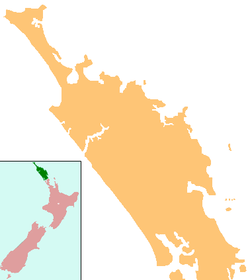
 Herekino
Coordinates: 35°15′53″S 173°12′38″E / 35.26472°S 173.21056°E Country New Zealand Region Northland Region District Far North District Population (2006) – Total 1,947 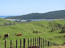 Glimpse of the harbour
Herekino is a locality in Northland, New Zealand. It lies 26 km south west of Kaitaia. The Herekino Harbour, also called the Herekino River, is an estuary and inlet from the Tasman Sea to the west. The Herekino Forest, which contains a stand of large kauri, is to the north, and the Tauroa Peninsula lies to the north west.[1]
The population was 1947 in the 2006 Census, down from 2055 in 2001.[2]
The harbour is mostly above water at high tide, with just a shallow entrance channel. The upper reaches of the harbour contain a mangrove forest.[3] The township of Herekino is at the north east end of the estuary, and the small settlement of Owhata lies on the rocky south shore of the harbour entrance. Owhata is a flat grassy area, with a fairly shallow beach of mud and sand. There is not much natural shelter, and there is a limited supply of fresh water in summer.[4]
Contents
Etymology
Herekino was named by the Māori chief Tohe, who passed through on the way to visit the local chief Taunaha at Owhata and noticed a lasso-type of bird trap which had been incorrectly tied, which would cause the prey unnecessary suffering. He named the area Herekino-a-Taunaha (the false knot of Taunaha).[5]
History
Ngāti Ruānui (now Te Aupōuri) dominated the Herekino and Whangape harbours and several battles were fought against other iwi in the area before European settlement.[6]
In 1846, the brig H.M.S. Osprey mistook the Herekino Heads with the entrance to the Hokianga, about 30 km to the south, due to misty weather and the similarity of the two features - both have a northern head formed by sand dunes. The Osprey was driven ashore on the shallow sand bank just north of the headland. No lives were lost. Wreckage is still visible. Herekino was named on some charts as "False Hokianga" due to the similarity of the entrances.[5]
Dalmatian immigrants were growing grapes in Herekino by the late 1890s and by 1906, there were 14 vineyards.[7]
In the mid 1960s Herekino was a small township with shops - a butcher, a petrol station and more. However following the sealing of State Highway 1 through the Mangamuka Gorge to Kaitaia, the township quickly declined.
Education
Herekino School is a coeducational full primary (years 1-8) school with a decile rating of 2 and a roll of 61.[8]
Coordinates: 35°15′53″S 173°12′38″E / 35.26472°S 173.21056°E
Notes
- ^ "Kaitāia and district". Te Ara Encyclopedia of New Zealand. http://www.teara.govt.nz/Places/Northland/NorthlandPlaces/2/en.
- ^ Quickstats about Herekino
- ^ "Description of Area: Hokianga, Whangape and Herekino Harbours". Northland Marine Library. http://www.marinenz.org.nz/nml/files/maps/coastal_units/4.03_hokianga-harbour/4.03_description.html.
- ^ Parkes, W. F. (c.1965). The Visitors' Guide to the Far North - Mangonui County (3rd ed.). pp. p.14.
- ^ a b Parkes, W. F. (c.1965). The Visitors' Guide to the Far North - Mangonui County (3rd ed.). pp. p.13.
- ^ "Te Aupōuri and Te Rarawa". Te Ara Encyclopedia of New Zealand. http://www.teara.govt.nz/NewZealanders/MaoriNewZealanders/MuriwhenuaTribes/3/en.
- ^ "Farming, fishing, winemaking". Te Ara Encyclopedia of New Zealand. http://www.teara.govt.nz/NewZealanders/NewZealandPeoples/Dalmatians/4/en.
- ^ "Te Kete Ipurangi". Ministry of Education. http://www.tki.org.nz/e/schools/display_school_info.php?school_id=1013.
Categories:- Far North District
- Populated places in New Zealand
- Ports and harbours of New Zealand


Wikimedia Foundation. 2010.