Gmina Przykona

Gmina Przykona

Infobox Settlement
name = Gmina Przykona
other_name = Przykona Commune
settlement_type = Gmina
total_type = Total


image_shield = POL Przykona COA.svg


subdivision_type = Country
subdivision_name = POL
subdivision_type1 = Voivodeship
subdivision_name1 = Greater Poland
subdivision_type2 = County
subdivision_name2 = Turek
area_total_km2 = 110.93
population_total = 4173
population_as_of = 2006
population_density_km2 = auto
coor_type = Przykona
latd = 51
latm = 59
lats =
latNS = N
longd = 18
longm = 37
longs =
longEW = E
seat = Przykona
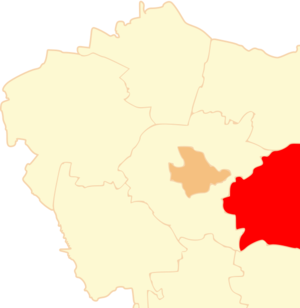
website = http://www.przykona.pl/
__NOTOC__Gmina Przykona is a rural gmina (administrative district) in Turek County, Greater Poland Voivodeship, in west-central Poland. Its seat is the village of Przykona, which lies approximately convert|9|km|mi|0 south-east of Turek and convert|125|km|mi|0|abbr=on east of the regional capital Poznań.

The gmina covers an area of convert|110.93|km2|sqmi|1, and as of 2006 its total population is 4,173.

Neighbouring gminas

Gmina Przykona is bordered by the gminas of Brudzew, Dobra, Kawęczyn, Turek and Uniejów.

References

* [http://www.stat.gov.pl/gus/45_655_PLK_HTML.htm Polish official population figures 2006]


Wikimedia Foundation. 2010.

Игры ⚽ Поможем решить контрольную работу

Look at other dictionaries:

  • Dąbrowa, Gmina Przykona — For other places with the same name, see Dąbrowa (disambiguation). Dąbrowa   Village   Country Poland …   Wikipedia

  • Gmina Malanów — Malanów Commune   Gmina   …   Wikipedia

  • Przykona — Przykona …   Deutsch Wikipedia

  • Gmina Turek — Infobox Settlement name = Gmina Turek other name = Turek Commune settlement type = Gmina total type = Total image shield = POL gmina Turek COA.svg subdivision type = Country subdivision name = POL subdivision type1 = Voivodeship subdivision name1 …   Wikipedia

  • Gmina Uniejów — Infobox Settlement name = Gmina Uniejów other name = Uniejów Commune settlement type = Gmina total type = Total image shield = POL Uniejów COA.svg subdivision type = Country subdivision name = POL subdivision type1 = Voivodeship subdivision name1 …   Wikipedia

  • Gmina Brudzew — Infobox Settlement name = Gmina Brudzew other name = Brudzew Commune settlement type = Gmina total type = Total image shield = POL gmina Brudzew COA.svg subdivision type = Country subdivision name = POL subdivision type1 = Voivodeship subdivision …   Wikipedia

  • Gmina Dobra, Greater Poland Voivodeship — Infobox Settlement name = Gmina Dobra other name = Dobra Commune settlement type = Gmina total type = Total image shield = POL Dobra (powiat turecki) COA.svg subdivision type = Country subdivision name = POL subdivision type1 = Voivodeship… …   Wikipedia

  • Gmina Kawęczyn — Infobox Settlement name = Gmina Kawęczyn other name = Kawęczyn Commune settlement type = Gmina total type = Total image shield = POL gmina Kawęczyn COA.svg subdivision type = Country subdivision name = POL subdivision type1 = Voivodeship… …   Wikipedia

  • Młyniska, Greater Poland Voivodeship — For other places with the same name, see Młyniska (disambiguation). Młyniska   Village   …   Wikipedia

  • Olszówka, Turek County — For other places with the same name, see Olszówka. Olszówka   Village   …   Wikipedia

Share the article and excerpts

Direct link
Do a right-click on the link above
and select “Copy Link”