Chos Malal Department

Chos Malal Department
Chos Malal
—  Department  —
Country Argentina
Province Neuquén
Capital Chos Malal
Area
 - Total 4,330 km2 (1,671.8 sq mi)
Population (2001)
 - Total 14,185
 - Density 3.3/km2 (8.5/sq mi)
Important cities Chos Malal
  • Caepe Malal
  • Chapua
  • Costa Tilhue
  • Coyuco-Cochico
  • El Alamito
  • La Salada
  • Lonco Vaca
  • Los Menucos
  • Tricao Malal
  • Villa Curí Leuvú

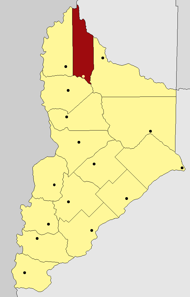
Chos Malal is a department located in the north of Neuquén Province, Argentina.

Geography

The Department limits with Chile at the North, Mendoza Province at the nordeast, Pehuenches Department at southeast, Ñorquín Department at southwest and Minas Department at west.

Coordinates: 37°22′42″S 70°16′20″W / 37.37833°S 70.27222°W / -37.37833; -70.27222


Wikimedia Foundation. 2010.

Игры ⚽ Нужен реферат?

Look at other dictionaries:

  • Chos Malal — Chos Malal …   Wikipedia

  • Ñorquín Department — Ñorquín   Department   Country …   Wikipedia

  • Minas Department, Neuquén — Minas   Department   Country Argentina …   Wikipedia

  • Confluencia Department — Confluencia   Department   Country …   Wikipedia

  • Collón Curá Department — Collón Curá   Department   Country …   Wikipedia

  • Departments of Argentina — Argentina This article is part of the series: Politics and government of Argentina Constitution Government …   Wikipedia

  • Las Ovejas — is a town located in Minas Department, in Neuquén Province, Argentina. Geography The town is located 38 km from Andacollo capital city of the department, 96 km from Chos Malal the capital city of Minas Department and 492 km from Neuquén, the… …   Wikipedia

  • Patagonia — For other uses, see Patagonia (disambiguation). Official map of cartographer of the King of Spain, Juan de la Cruz Cano y Olmedilla, 1775. Patagonia is a region located in Argentina and Chile, integrating the southernmost section of the A …   Wikipedia

  • Neuquén, Argentina — Neuquén redirects here. For other uses, see Neuquén (disambiguation). Neuquén   City   (From top to bottom; from left to right) Aerial view …   Wikipedia

  • National Route 40 (Argentina) — Map of Argentina, showing Route 40, in red National Route 40 or RN40, often called Ruta 40 even in English texts[1], is a route in western Argentina, stretching from Cabo Virgenes in Santa Cruz Province in the south to La Quiaca …   Wikipedia

Share the article and excerpts

Direct link
Do a right-click on the link above
and select “Copy Link”