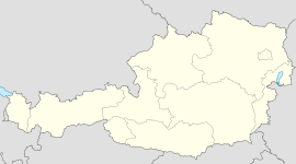
- Dietach
-
Dietach Country Austria State Upper Austria District Steyr-Land Mayor Karl Schweinschwaller (ÖVP) Area 21 km2 (8 sq mi) Elevation 313 m (1027 ft) Population 2,923 (1 January 2011)[1] - Density 139 /km² (361 /sq mi) Time zone CET/CEST (UTC+1/+2) Licence plate SE Postal code 4407 Area code 07252 Website www.dietach.at Coordinates: 48°05′31″N 14°24′58″E / 48.09194°N 14.41611°E
Dietach is a municipality in the district of Steyr-Land in Upper Austria, Austria.
References
Adlwang · Aschach an der Steyr · Bad Hall · Dietach · Gaflenz · Garsten · Großraming · Laussa · Losenstein · Maria Neustift · Pfarrkirchen bei Bad Hall · Reichraming · Rohr im Kremstal · Schiedlberg · Sierning · Sankt Ulrich bei Steyr · Ternberg · Waldneukirchen · Weyer · Wolfern
Categories:- Cities and towns in Upper Austria
- Upper Austria geography stubs
Wikimedia Foundation. 2010.


