- Pegnitz River
Infobox River | river_name = Pegnitz
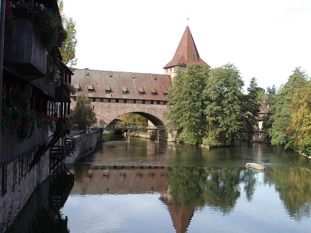
caption = The Pegnitz in Nuremberg.
origin =Franconia
mouth =Regnitz
basin_countries =Germany
length = 115 km
elevation = 425 m
discharge =
watershed = The Pegnitz is a small river inFranconia in the Germanfederal state ofBavaria . The Pegnitz has its source in the city of the same name at an altitude of 425 m and meets theRednitz at 283 m northwest ofFürth . From that point on the river is calledRegnitz .The Pegnitz is about 115 km long.
The river is inhabited by numerous
ducks ,coots ,swans , andgulls .Affluences
* Flembach (creek) (left affluence)
* Hirschbach (creek) (left affluence)
* Högenbach (creek) (left affluence from the Pommelsbrunn direction)
* Happurger Bach (creek) (left affluence)
* Sittenbach (creek) (right affluence)
* Hammerbach (creek) (left affluence)
* Sandbach (creek) (left affluence)
* Schnaittach (creek) (right affluence)
* Röttenbach (creek) (right affluence)
* Bitterbach (creek) (right affluence)
* Röthenbach (creek) (left affluence)
* Langwassergraben (creek) (right affluence)
* Tiefgraben (creek) (right affluence)
* Goldbach (creek) (left affluence)Cities on the Pegnitz
From source to mouth:
* Pegnitz
* Neuhaus on the Pegnitz
*Hersbruck
*Lauf an der Pegnitz
*Röthenbach an der Pegnitz
*Nuremberg : Within city limits (about 14 km), the river forms secondary arms. Numerousbridge s and footbridges cross the river, such as the unchangedRenaissance bridge "Fleischbrücke " (1598) and the ironsuspension bridge "Kettensteg", dating from 1824. To the west of the Maxbrücke there is aweir . In the western part of the city, the river has been renaturalized one section at a time from 1998 to 2001, using the historicalriver bed as orientation.*
Fürth : Numerous bridges and footbridges exist. As part of project "Uferstadt" (riverside city), the redesign of the former Grundig site, the river has been put into a nature-like bed in 2003. On a length of one kilometer, two new loops and shallowed banks have been created, and part of the former river bed have been kept in the form of backwaters. These tasks have been cofinanced by theEuropean Union .History
After the big
flood in February 1909, straightening has shortened the river by four kilometers within the Nuremberg city limits.Since 1996 planning and actions are progressing trying to lengthen the course of the river between Nuremberg and Fürth again and to shape it in a nature-oriented way.
External links
*
* http://www.bayern.de/wwa-n/stadtamfluss.htm - Wasserwirtschaftsamt Nürnberg: "Die Umgestaltung der Pegnitz in Nürnberg"
Wikimedia Foundation. 2010.