Mantsonyane

Mantsonyane
Mantsonyane
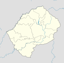
Mantsonyane is located in Lesotho
Mantsonyane
Location in Lesotho
Coordinates: 29°34′S 28°16′E / 29.567°S 28.267°E / -29.567; 28.267Coordinates: 29°34′S 28°16′E / 29.567°S 28.267°E / -29.567; 28.267
Country Flag of Lesotho.svg Lesotho
District: Thaba-Tseka District
Constituency Mantsonyane

Mantsonyane is a town in central Lesotho. It is located southeast of the capital Maseru, close to the western approach to the Mokhoabong Pass, on a high mountain plateau between the towns of Marakabei and Thaba-Tseka.

St James' Hospital and regional health care

In 1963 the Anglican Church opened, through its USPG mission agency, a mission hospital in Mantsonyane. St James' Hospital has grown significantly and is now a major feature of the community. In addition to providing full hospital facilities (with 60 beds) to local residents, the hospital also operates a number of satellite health care facilities in the surrounding region, including six health centres, one health clinic, and two rural village health posts.[1] USPG Anglican missionary medical staff and administrators operate the hospital, which also employs local nursing and domestic staff.

References

  • Fitzpatrick, M., Blond, B., Pitcher, G., Richmond, S., and Warren, M. (2004) South Africa, Lesotho and Swaziland. Footscray, VIC: Lonely Planet.
  1. ^ Full details of the hospital are available on-line here.

Wikimedia Foundation. 2010.

Игры ⚽ Нужно сделать НИР?

Look at other dictionaries:

  • Thaba-Tseka District — Thaba Tseka is a district of Lesotho. It has an area of 4,270 km² and a population of approximately 170,000 (2004). Thaba Tseka is also the name of the district s capital or camptown, which is the only town in the district.In the east, Thaba… …   Wikipedia

  • Mokhoabong Pass — The Mokhoabong Pass is a mountain pass in central Lesotho. The A3 road crosses this pass between the towns of Mantsonyane and Thaba Tseka. References Fitzpatrick, M., Blond, B., Pitcher, G., Richmond, S., and Warren, M. (2004) South Africa,… …   Wikipedia

  • A3 highway (Lesotho) — The A3 is one of the main highways of Lesotho in southern Africa. The A3 crosses the Mokhoabong Pass between the towns of Mantsonyane and Thaba Tseka. References*Fitzpatrick, M., Blond, B., Pitcher, G., Richmond, S., and Warren, M. (2004) South… …   Wikipedia

  • Justin Lekhanya — Justin Metsing Lekhanya (* 7. April 1938 in Thaba Tseka, Lesotho) war ein lesothischer General und Politiker. Von 1986 bis 1991 war er Premierminister, Verteidigungsminister und Vorsitzender des Militärrates von Lesotho. Lekhanya wurde nach einem …   Deutsch Wikipedia

  • Justin Metsing Lekhanya — (* 7. April 1938 in Thaba Tseka, Lesotho) war ein lesothischer General und Politiker. Von 1986 bis 1991 war er Premierminister, Verteidigungsminister und Vorsitzender des Militärrates von Lesotho. Lekhanya wurde nach einem unblutigen… …   Deutsch Wikipedia

  • Lekhanya — Justin Metsing Lekhanya (* 7. April 1938 in Thaba Tseka, Lesotho) war ein lesothischer General und Politiker. Von 1986 bis 1991 war er Premierminister, Verteidigungsminister und Vorsitzender des Militärrates von Lesotho. Lekhanya wurde nach einem …   Deutsch Wikipedia

  • Thaba-Tseka (Distrikt) — Karte Lage des Thaba Tseka Distrikts in Lesotho Basisdaten Verwaltungsstadt Thaba Tseka Fläche 4.270 km² …   Deutsch Wikipedia

  • List of A3 roads — This is a list of roads designated A3. Roads entries are sorted in the countries alphabetical order. A003 road (Argentina), a road connecting the junction with National Route 9 and Camino de Cintura to Tigre A3 road (Australia) may refer to  …   Wikipedia

  • FXMN — ICAO Airportcode f. Mantsonyane (Lesotho) …   Acronyms

  • FXMN — ICAO Airportcode f. Mantsonyane ( Lesotho) …   Acronyms von A bis Z

Share the article and excerpts

Direct link
Do a right-click on the link above
and select “Copy Link”