- Guadalupe, Nuevo León
Infobox City
official_name = Ciudad Guadalupe
native_name =
nickname = Guadalupe
motto =
imagesize =
image_caption =
image_
image_shield = Guadalupe coat of arms.gif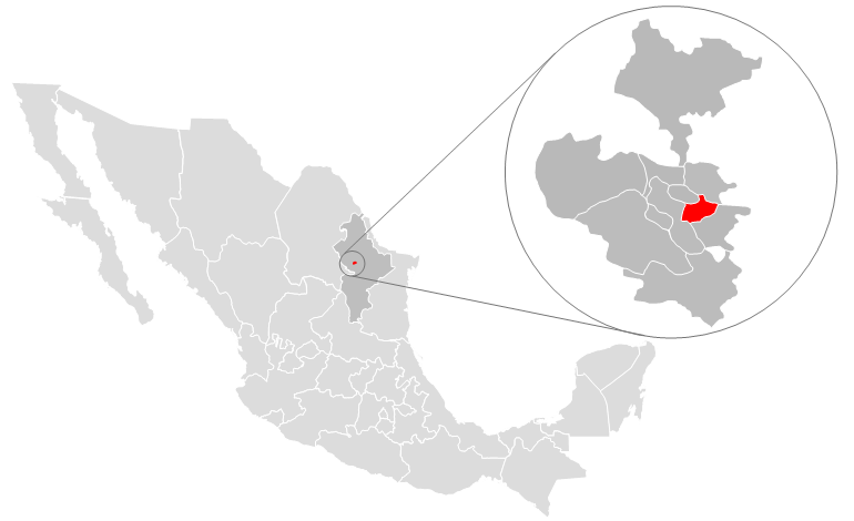
mapsize = 220px
map_caption =
subdivision_type = Country
subdivision_name =Mexico
subdivision_type1 = State
subdivision_name1 =Nuevo León
subdivision_type2 =
subdivision_name2 =
government_type =
leader_title = Mayor
leader_name = Mrs. Cristina Díaz Salazar (PRI party)
leader_title1 =
leader_name1 =
leader_title2 =
leader_name2 =
leader_title3 =
leader_name3 =
established_title = Founded
established_date =January 4 ,1716
established_title2 =
established_date2 =
established_title3 =
established_date3 =
area_magnitude =
area_total_km2 = 151.3
area_total_sq_mi =
area_land_km2 =
area_land_sq_mi =
area_water_km2 =
area_water_sq_mi =
area_water_percent =
area_urban_km2 =
area_urban_sq_mi =
area_metro_km2 =
area_metro_sq_mi =
population_as_of = 2005
population_note =
population_total = 691,931
population_density_km2 =
population_density_sq_mi =
population_metro = 3,664,334
population_density_metro_km2 =
population_density_metro_sq_mi =
population_urban =
timezone = Central Standard Time
utc_offset = -6
timezone_DST = Central Daylight Time
utc_offset_DST = -5
latd = 25| latm=41 | lats= | latNS=N
longd = 100 | longm=16 | longs= | longEW=W
elevation_m = 500
elevation_ft =
postal_code_type =
postal_code =
website = http://www.guadalupe.gob.mx
footnotes =Guadalupe is a city and it surrounding municipality located in the state of
Nuevo León , in northernMexico . It is part of the GreaterMonterrey Metropolitan area . The municipality of Guadalupe, which lies adjacent to the east side ofMonterrey , also borders the municipalities ofSan Nicolás de los Garza ,Apodaca ,Pesquería , and Juárez. Covering a territory of 151.3 km², it is located at coord|25|41|N|100|16|W|, at an altitude of 500 meters above sea level. As of the 2005 census its official population was 691,434 in the city and 691,931 in the entire municipality. It is the second-largest city and municipality in the state. The municipality has an area of 151.3 km² (58.42 sq mi).The city was founded on
January 4 ,1716 , but the land was inhabited long before that. When Monterrey was founded in1596 , the land, which was populated by various indigenous tribes, was ceded toDiego de Montemayor , the founder of Monterrey, but he did not make use of the land. In1627 , the land was turned into large plantations, where sugar cane and corn was raised. The owner of the land during around the time of the turn of the18th century was namedCapitán Nicolás Ochoa de Elejalde , but the land was taken from him by the Spanish government and converted into a mission in February,1715 . In1756 , the city was renamed the "Pueblo de la Nueva Tlaxcala de Nuestra Señora de Guadalupe de Horcasitas". OnMarch 5 ,1825 , the city was declared a municipality of Nuevo León and categorized as a "villa", even though for many years it continued to be called the "Villa de Guadalupe".References
* [http://www.inegi.gob.mx/est/contenidos/espanol/sistemas/conteo2005/localidad/iter/ Link to tables of population data from Census of 2005] INEGI: Instituto Nacional de Estadística, Geografía e Informática
* [http://www.e-local.gob.mx/wb2/ELOCAL/EMM_nuevoleon Nuevo León] Enciclopedia de los Municipios de MéxicoExternal links
*es icon [http://www.guadalupe.gob.mx Ciudad Guadalupe] Official website
Wikimedia Foundation. 2010.