- Bukovské vrchy
Geobox| Range
name = Bukovské vrchy
native_name =
other_name = _en. Bukovec Mountains
other_name1 =
image_size =
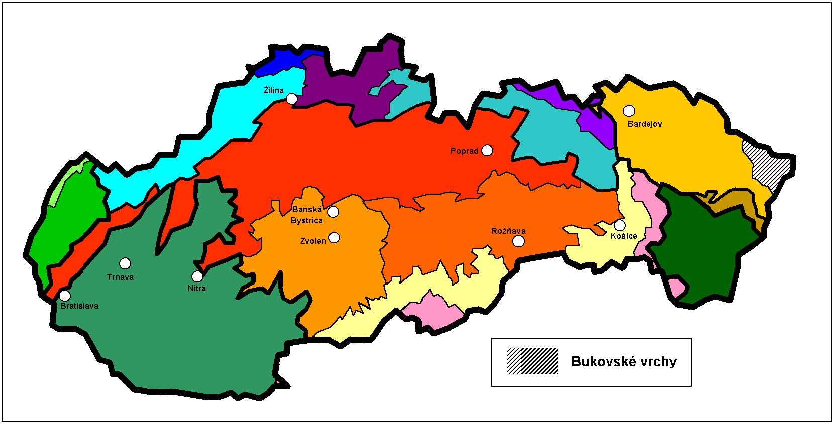
image_caption = Location
country = Slovakia
country1 =
state =
state1 =
region =Prešov Region
region1 =
district =
district1 =
city =
city1 =
parent =Poloniny
unit1 =
border =Lower Beskids
border1 =
geology =
geology1 =
period =
period1 =
orogeny =
orogeny1 =
area =
length =
length_orientation =
length_round =
width =
width_orientation =
width_round =
highest = Kremenec
highest location =
highest_country =
highest_state =
highest_region =
highest_district =
highest_elevation = 1221
highest_lat_d =
highest_lat_m =
highest_lat_s =
highest_lat_NS =
highest_long_d =
highest_long_m =
highest_long_s =
highest_long_WE =
lowest =
lowest_location =
lowest_country =
lowest_state =
lowest_region =
lowest_district =
lowest_elevation =
lowest_lat_d =
lowest_lat_m =
lowest_lat_s =
lowest_lat_NS =
lowest_long_d =
lowest_long_m =
lowest_long_s =
lowest_long_WE =
woods =
free_name =
free_value =
map_size =
map_caption =
map_first =Bukovské vrchy (usually translated as Bukovec Mountains) is a
flysch mountain range in north-easternSlovakia , belonging to theEastern Carpathians . It is located in thePrešov Region near the borders withPoland (Bieszczady ) andUkraine .The highest mountain is
Kremenec at 1,221 m AMSL.Original flora and fauna was preserved because of the area's remoteness. The mountain range is covered with beech forests. The area is protected by
Poloniny National Park . Localities Havešová,Stužica and Rožok are inscribed on theUNESCO World Heritage Site list.External links
* [http://hiking.sk/hk/li/sluzby-galeria.html?oblast=109 Images at Hiking.sk]
Wikimedia Foundation. 2010.