- Bakau
Infobox Settlement
official_name =PAGENAME
other_name =
native_name =
nickname =
settlement_type =
motto =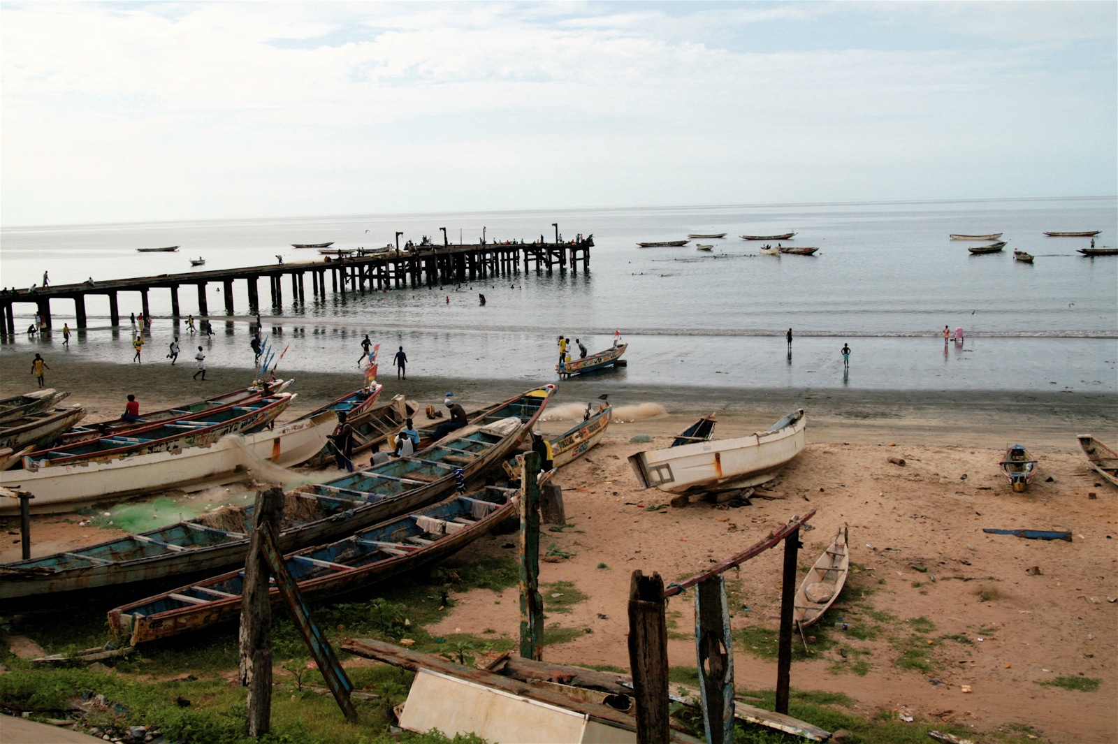
imagesize = 300px
image_caption =
flag_size =
image_
seal_size =
image_shield =
shield_size =
image_blank_emblem =
blank_emblem_type =
blank_emblem_size =
mapsize =
map_caption =
mapsize1 =
map_caption1 =
image_dot_
dot_mapsize =
dot_map_caption =
dot_x = |dot_y =
pushpin_
pushpin_mapsize =300
pushpin_label_position =bottom
pushpin_map_caption =Location in The Gambia
subdivision_type = Country
subdivision_name =The Gambia
subdivision_type1 = Division
subdivision_name1 = Western Division
subdivision_type2 = District
subdivision_name2 =
subdivision_type3 =
subdivision_name3 =
subdivision_type4 =
subdivision_name4 =
government_footnotes =
government_type =
leader_title =
leader_name =
leader_title1 =
leader_name1 =
leader_title2 =
leader_name2 =
leader_title3 =
leader_name3 =
leader_title4 =
leader_name4 =
established_title =
established_date =
established_title2 =
established_date2 =
established_title3 =
established_date3 =
area_magnitude =
unit_pref =Imperial
area_footnotes =
area_total_km2 =
area_land_km2 =
area_water_km2 =
area_total_sq_mi =
area_land_sq_mi =
area_water_sq_mi =
area_water_percent =
area_urban_km2 =
area_urban_sq_mi =
area_metro_km2 =
area_metro_sq_mi =
area_blank1_title =
area_blank1_km2 =
area_blank1_sq_mi =
population_as_of =
population_footnotes =
population_note =
population_total =
population_density_km2 =
population_density_sq_mi =
population_metro =
population_density_metro_km2 =
population_density_metro_sq_mi =
population_urban =
population_density_urban_km2 =
population_density_urban_sq_mi =
population_blank1_title =Ethnicities
population_blank1 =
population_blank2_title =Religions
population_blank2 =
population_density_blank1_km2 =
population_density_blank1_sq_mi =
timezone =
utc_offset =
timezone_DST =
utc_offset_DST =
latd=13|latm=29|lats= |latNS=N
longd=16|longm=41|longs=|longEW=W
elevation_footnotes =
elevation_m =
elevation_ft =
postal_code_type =
postal_code =
area_code =
blank_name =
blank_info =
blank1_name =
blank1_info =
website =
footnotes =Bakau is a town on the
Atlantic Ocean coast of TheGambia , lying west ofBanjul . It is known for itsbotanical gardens , its crocodile pool "Bakau Kachikally " and for thebeach es at Cape Point. It is the first major suburb outsideBanjul and the most developed town in The Gambia. BetweenBanjul isSerrekunda History
Legend has it that Bakau grew up around the holy crocodile pool in the central district of Bakau, Kachikally. Bakau itself was a small village at the turn of the 19th century and grew in importance as it became a favourite place for private residences of colonial administrators especially along the beautiful palm fringed beaches.Despite being a major town, the old village still exists and is run like any other in
The Gambia with an Alkali and divided into "Kabilos".Interestingly, there exists a much smaller village within the old village called Bakau Wasulung Kunda, indicating the migrant origins of its inhabitants. As people began to move out ofBanjul , government allocated residential areas quickly sprung around the old village, acquiring new names in the process. What were farms of the local population became well planned suburbs filled with bungalows such as Fajara, New Town and Cape Point.Economy
Tourism is the most important business activity in Bakau providing a lot of employment, as well as income for the municipal authority. At Cape Point there are a few hotels on a beach, arguably superior to the main Atlantic ocean beach, which is home to most of the hotels in the country. In town there are a few [http://www.realafrica.net guest houses] . There is also a major market along the main road famous for its fruit and vegetables. Most banks have branches there and several companies also maintain offices there.
Fishing is also another major business activity and there is a fishing port by the town beach together with a wharf where a market attracts many visitors. One of the few ice plants in the country is located there.
Education
Bakau Primary school, established in 1947, is one of the oldest schools in the country. [http://www.niica.on.ca/gambia/Region1.aspx] Today there are other lower basic schools as well a several high schools, both public and private.
The Medical Research Council is also located within a fenced complex. The MRC has a long history in The Gambia and is a leading global centre of excellence in
malaria research. [http://www.mrc.ac.uk/prn/index/about/about-research_centres/about-unit_details.htm?ID=17]Infrastructure
Bakau is perhaps the most developed settlement in The Gambia with excellent communication facilities. Nearly all the roads are paved and the rate of electricity connection is almost universal. There are several hotels and the only national Stadium, The Independence Stadium, is located here.
The national broadcaster, Radio Gambia, is located in Bakau at its Mile 7 studios. There is also a large military camp, a police barracks and a fire brigade.
Attractions
*Kachikally Crocodile Pool
*Botanical Gardens
*Fajara Hotel
*Ocean bay Hotel
*African Village Hotel
*Cape Point Hotel
*SunBeach Hotel
*The Garden Guest HousePersonality
*
Njogu Demba-Nyrén References
External links
* [http://www.accessgambia.com/information/bakau-gambia-resort.html Bakau Hotels, Photos, Information and Map]
* [http://www.kingslangleybakau.org Bakau is linked to Kings Langley, a village in Hertfordshire, UK]

Wikimedia Foundation. 2010.