- Waterland
Infobox Settlement
official_name = Waterland
imagesize = 250px
image_caption = The villageMarken 
flag_size = 150x75px
image_shield = Waterlandwapen.jpg
shield_size = 150x75px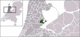
mapsize = 250px
map_caption = Location of Waterland
subdivision_type = Country
subdivision_name =Netherlands
subdivision_type1 = Province
subdivision_name1 =North Holland
leader_name = E.F. Jongmans
leader_party = CDA
area_footnotes = (2006)
area_total_km2 = 115.64
area_land_km2 = 52.10
area_water_km2 = 63.54
population_as_of =1 January ,2007
population_note = Source: CBS, [http://statline.cbs.nl/ Statline] .
settlement_type = Municipality
population_total = 17166
population_density_km2 = 329
timezone = CET
utc_offset = +1
timezone_DST = CEST
utc_offset_DST = +2
latd = 52.47
latNS = N
longd = 5.03
longEW = E
website = [http://www.waterland.nl www.waterland.nl].
Population centres
The municipality of Waterland consists of the following cities, towns, villages and/or districts:
Broek in Waterland ,Ilpendam ,Katwoude ,Marken ,Monnickendam ,Overleek ,Uitdam ,Watergang ,Zuiderwoude .Local government
The municipal council of Waterland consists of 17 seats, which are divided as follows:
* CDA - 5 seats
*GroenLinks - 3 seats
* Waterland95 - 3 seats
* Algemeen Belang - 2 seats
* PvdA - 2 seats
* VVD - 2 seatsReferences
* Statistics are taken from the [http://www.sdu.nl/staatscourant/gemeentes/gem518nh.htm SDU Staatscourant]
External links
* [http://www.plattegronden.nl/gemeentewaterland/index.html Map of the municipality Waterland]
Wikimedia Foundation. 2010.