Crawleyside

Crawleyside
Crawleyside

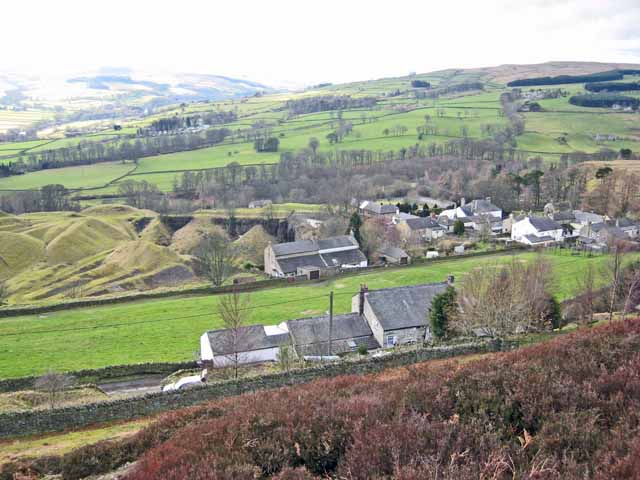
Crawleyside is a village in County Durham, in England. It is situated to the north of Stanhope, in Weardale.

Crawleyside holds many entrances to Stanhope Dene.

Crawleyside is home to Ashes Quarry, an old mining facility now used as farmland.

External links

Media related to Crawleyside at Wikimedia Commons

Coordinates: 54°46′N 2°01′W / 54.76°N 2.01°W / 54.76; -2.01


Wikimedia Foundation. 2010.

Игры ⚽ Нужно решить контрольную?

Look at other dictionaries:

  • List of places in County Durham — Location map+|County Durham caption = Some of the larger settlements of County Durham. float = right width = 400 places = Location map |County Durham label = Barnard Castle long = 1.92 lat = 54.55 background = white Location map |County Durham… …   Wikipedia

  • Stanhope, County Durham — Infobox UK place country = England official name= Stanhope population = 1,633 (2001 Census) [ [http://www.durham.gov.uk/durhamcc/usp.nsf/Lookup/Wear%20Valley%20Settlement%20Summary%20Sheets%20Numbers/$file/Wear+Valley+Settlement+Summary+Sheets+Num… …   Wikipedia

  • Stanhope (Durham) — Wappen Karte keines vorhanden keine vorhanden Basisdaten Land Großbritannien Unitary Authority County Durham County Durham …   Deutsch Wikipedia

  • Liste des villes du comté de Durham — C est la liste des villes, villages et hameaux du comté de Durham. Sommaire : Haut A B C D E F G H I J K L M N O P Q R S T U V W X Y Z A Aislaby, Allensford, Annfield Plain …   Wikipédia en Français

Share the article and excerpts

Direct link
Do a right-click on the link above
and select “Copy Link”