- Westerveld
Infobox Settlement
official_name = Westerveld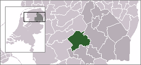
mapsize = 280px
subdivision_type = Country
subdivision_name =Netherlands
subdivision_type1 = Province
subdivision_name1 =Drenthe
area_footnotes = (2006)
area_total_km2 = 282.75
area_land_km2 = 278.99
area_water_km2 = 3.76
population_as_of =1 January ,2007
population_note = Source: CBS, [http://statline.cbs.nl/ Statline] .
settlement_type = Municipality
population_total = 19294
population_density_km2 = 69
timezone = CET
utc_offset = +1
timezone_DST = CEST
utc_offset_DST = +2Westerveld (Pronunciation|037 Westerveld.ogg) is a
municipality in the northeasternNetherlands .The municipality Westerveld was established in 1998 out of de municipalities of Diever, Dwingeloo, Havelte en Vledder.Westerveld is being crossed by a channel the
Drentsche Hoofdvaart . There are also two National Parks situated in the municipality, theDrents-Friese Wold andDwingelerveld .Population centres
Boschoord ,Darp ,Diever ,Dieverbrug ,Doldersum ,Dwingeloo ,Eemster ,Frederiksoord ,Geeuwenbrug ,Havelte ,Havelterberg ,Leggeloo ,Lhee ,Lheebroek ,Nijensleek ,Oude Willem ,Uffelte ,Vledder ,Vledderveen ,Wapse ,Wapserveen ,Wateren ,Wilhelminaoord ,Wittelte andZorgvlied .Dwingeloo is a town halfway between
Meppel andAssen . The radio telescope of theDwingeloo Radio Observatory is located on the edge of the Dwingeloo Heath, 3 km south of the village.External links
* [http://www.gemeentewesterveld.nl/ Official website of the municipality]
* [http://www.dorpdiever.nl/ Touristic website of the town of Diever]----
Wikimedia Foundation. 2010.