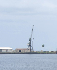
- Buchanan, Liberia
Infobox Settlement
official_name = Buchanan
other_name =
native_name =
nickname =
settlement_type =
motto =
imagesize = 280px
image_caption =
flag_size =
image_
seal_size =
image_shield =
shield_size =
image_blank_emblem =
blank_emblem_type =
blank_emblem_size =
mapsize =
map_caption =
mapsize1 =
map_caption1 =
image_dot_
dot_mapsize =
dot_map_caption =
dot_x = |dot_y =
pushpin_
pushpin_label_position =bottom
pushpin_mapsize =300
pushpin_map_caption =Location in Liberia
subdivision_type = Country
subdivision_name =
subdivision_type1 = County
subdivision_name1 =Grand Bassa County
subdivision_type2 = District
subdivision_name2 =
subdivision_type3 =
subdivision_name3 =
subdivision_type4 =
subdivision_name4 =
government_footnotes =
government_type =
leader_title =
leader_name =
leader_title1 =
leader_name1 =
leader_title2 =
leader_name2 =
leader_title3 =
leader_name3 =
leader_title4 =
leader_name4 =
established_title =
established_date =
established_title2 =
established_date2 =
established_title3 =
established_date3 =
area_magnitude =
unit_pref =Imperial
area_footnotes =
area_total_km2 =
area_land_km2 =
area_water_km2 =
area_total_sq_mi =
area_land_sq_mi =
area_water_sq_mi =
area_water_percent =
area_urban_km2 =
area_urban_sq_mi =
area_metro_km2 =
area_metro_sq_mi =
area_blank1_title =
area_blank1_km2 =
area_blank1_sq_mi =
population_as_of =
population_footnotes =
population_note =
population_total = 75,095
population_density_km2 =
population_density_sq_mi =
population_metro =
population_density_metro_km2 =
population_density_metro_sq_mi =
population_urban =
population_density_urban_km2 =
population_density_urban_sq_mi =
population_blank1_title =Ethnicities
population_blank1 =
population_blank2_title =Religions
population_blank2 =
population_density_blank1_km2 =
population_density_blank1_sq_mi =
timezone =
utc_offset =
timezone_DST =
utc_offset_DST =
latd=05|latm=52 |lats=51 |latNS=N
longd=10|longm=02|longs= 48|longEW=W
elevation_footnotes =
elevation_m =
elevation_ft =
postal_code_type =
postal_code =
area_code =
blank_name =
blank_info =
blank1_name =
blank1_info =
website =
footnotes =Buchanan is the second largest city in
Liberia , lying onWaterhouse Bay , part of theAtlantic Ocean . The town population was estimated at 75,095. Named for Thomas Buchanan, cousin of U.S. presidentJames Buchanan and first governor of Liberia, it is also the capital ofGrand Bassa and lies east ofMonrovia . The town was popular withrefugee s during theLiberian Civil War as it largely escaped the fighting.Fishing is another important industry in the town.Mining
Buchanan is the port for the dormant railway to the iron ore mines at Nimba.
References
* [http://www.fallingrain.com/world/LI/11/Buchanan.html FallingRain Map - elevation = 77m]
*
Wikimedia Foundation. 2010.

