- Kamijima, Ehime
Infobox City Japan
Name = Kamijima
JapaneseName = 上島町
Map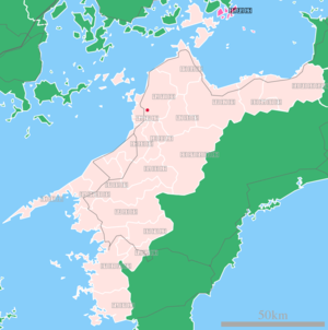
Region =Shikoku
Prefecture = Ehime
District = Ochi
Area_km2 = 30.38
Population = 8,116
PopDate =March 31 ,2006
Density_km2 = 267.15
Coords = coord|34|15|N|133|12|E|region:JP_type:city
Flower = nihongo|Sakura |桜
Tree = nihongo|"Quercus phillyraeoides"|姥目樫|Ubamegashi
Bird =
Symbol
SymbolDescription =
Mayor =
CityHallPostalCode = 794-2592
CityHallAddress = 210 Shimoyuge, Yuge, Kamijima-chō, Ochi-gun, Ehime-ken
CityHallPhone = (0897) 77-2500
CityHallLink = [http://www.town.kamijima.ehime.jp/ Town of Kamijima] |nihongo|Kamijima|上島町|Kamijima-chō is a town located in Ochi District, Ehime,Japan . OnOctober 1 ,2004 the town was formed from the merger of the following towns and villages: Ikina, Iwagi, Uoshima, and Yuge. The name Kamijima literally means "upper island"; the town consists of a number of islands in theSeto Inland Sea .As of
March 31 ,2006 , the town has an estimatedpopulation of 8,116 and a density of 267.15 persons per km². The total area is 30.38 km².External links
* [http://www.town.kamijima.ehime.jp/ Kamijima official website] in Japanese

Wikimedia Foundation. 2010.