- Rapid Creek, Northern Territory
Infobox Australian Place | type = suburb
name = Rapid Creek
city = Darwin
state = nt
caption =
lga =City of Darwin
postcode = 0810
est =
pop = 3,146 (2006) |pop_footnotes=Census 2006 AUS | id=SSC71121 | name = Rapid Creek (State Suburb) | quick = on | accessdate=2008-02-28]
area = 1.9
propval = $487,000 [ [http://www.domain.com.au/public/SuburbProfile.aspx?searchTerm=Rapid%20Creek&mode=buy#mapanchor 2006 Rapid Creek Property Value] ]
stategov = Nightcliff
fedgov = Solomon
near-nw = "Timor Sea "
near-n = "Timor Sea "
near-ne =
near-w = Nightcliff
near-e = Alawa
near-sw = Coconut Grove
near-s = Millner
near-se = Jingili
dist1 = 11
location1= DarwinRapid Creek is a northern suburb of the city of Darwin,
Northern Territory ,Australia .History
Although the precise circumstances of the naming of Rapid Creek remain obsure, the name must have been applied by Surveyor-General
George W. Goyder 's surveyors not long after the arrival of the 1869 Northern Territory Survey Expedition. The outline of the creek, running as it does from Marrara swamp to the sea between Casuarina Beach and Nightcliff, is present on Goyder's map, but no name appears on it. Goyder personally visited the locality on Saturday,3 April 1869 and described the creek, without naming it, as "a strong shallow stream near Night Cliff". Sometime between then and13 September , the name came into existence. There is an entry in Goyder's diary for the latter date which records that surveyor George MacLachlan was sent out to Rapid Creek to check on the availability of fresh water and good feed for the horses. On the basis of a satisfactory report from MacLachlan, "all the spare bullocks and horses were sent out to Rapid Creek to rest", two days later.From that time on, the name remained in common local usage and it is evident that settlers continued to visit the area regularly. In a book published in 1882, William Sowden described travelling from Palmerston (Darwin) to Casuarina Beach passing "Rapid Creek, which rushes swiftly along its bed during the wet season, but at other times during the dry.....its waters are clear and crystal". The year 1882 is also crucial because it saw the establishment of the first known permanent settlement in the area.
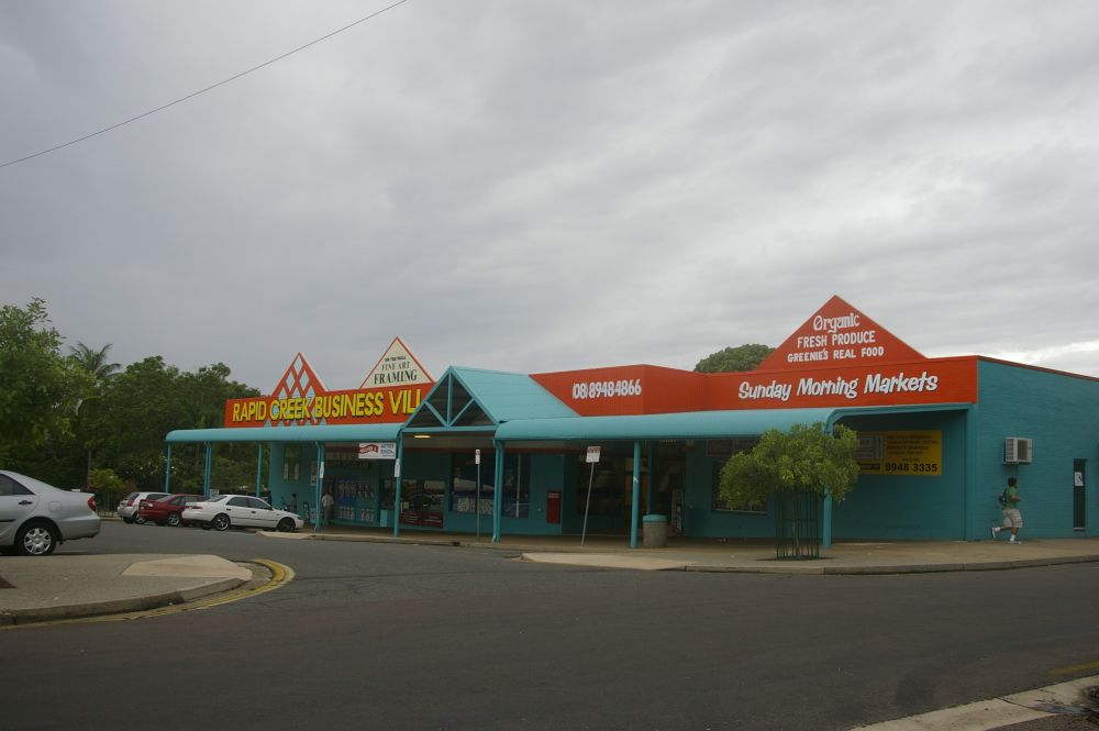
Rapid Creek is bounded by the
Timor Sea foreshore in the north, the Rapid Creek in the east,Trower Road in the south and Nightcliff Road in the west. Rapid Creek was originally established in the late 1800s when it was settled by theJesuit Mission, although this was abandoned before the turn of the century.Rapid Creek prior to
World War 2 was a favourite day trip / picnic area for Darwin people, along the bush track which was to becomeBagot Road and McMillans Road. AfterNightcliff grew as a seaside suburb in the 1950s, residential development expanded into the Rapid Creek area, primarily during the 1960s. The streets in Rapid Creek are mostly named after early Police Officers.Nightcliff and Rapid Creek were the first Darwin suburbs to feel the force of
Cyclone Tracy which came off theTimor Sea on25 December 1974 . Much of the residential housing was totally destroyed.Present Day
Rapid Creek is a predominantly residential area and is generally associated with its sister suburb, Nightcliff, and the adjacent northern suburbs of Millner and Coconut Grove. Both Rapid Creek and Nightcliff have arguably become Darwin's most popular suburbs, as they are mostly situated direclty on the coastal fringe. A lot of development has been completed on the coastal road, Casuarina Drive, which runs along the coast from Rapid Creek to Nightcliff.
References
* Barter, Leith. (1994). From wartime camp to garden suburb: a short history of Nightcliff and Rapid Creek. Historical Society of the Northern Territory. ISBN 0-6461989-7-1
* Darwin City Council. (2007). Community Profile: Rapid Creek. Retrived online (17 September 2007). http://www.id.com.au/darwin/commprofile/default.asp?id=146&gid=250&pg=1
* Northern Territory Government. (2007). The Origin of Suburbs, Localities, Towns and Hundreds in the Greater Darwin area. Retrived online 21 December 2007. http://www.nt.gov.au/lands/lis/placenames/origins/greaterdarwin.shtml#r
Wikimedia Foundation. 2010.