Waychinicup River

Waychinicup River

Infobox River
river_name = Waychinicup River


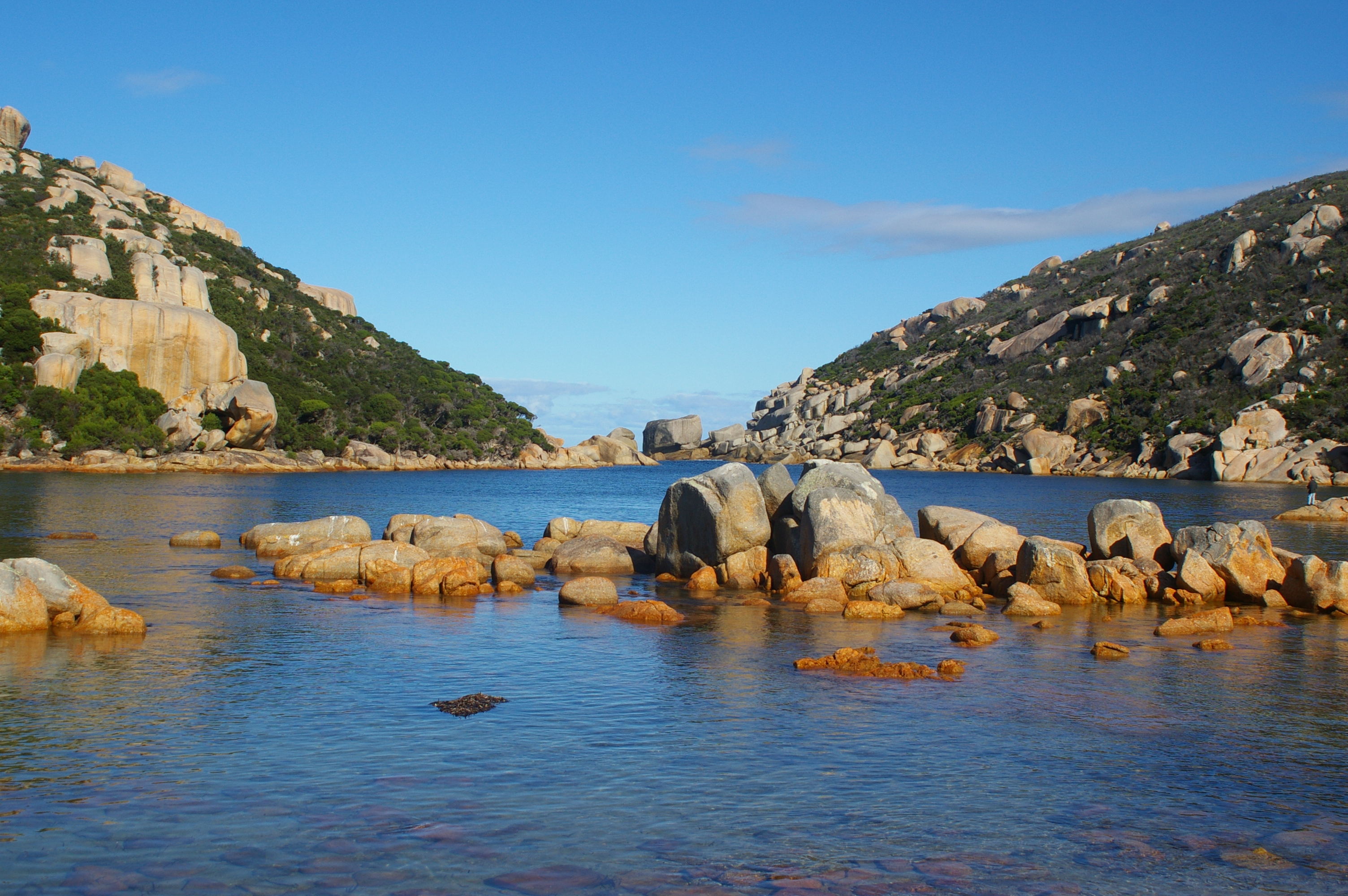
caption = Waychinicup Inlet
origin = near Manypeaks
mouth = Southern Ocean
basin_countries = Australia
length = 17 kilometres (10.6 mi)
elevation =
discharge = 8,560 ML/year [cite web|url=http://www.rivercare.scric.org/infodata/albhintc/waychinicupr/waychinicup.html|title=South Coast Rivercare - WaychinicupRiver|year=2007|accessdate=2007-09-08]
watershed = 14,500 hectares (35,829 acres)

The Waychinicup River is located in the Great Southern region of Western Australia. The headwaters of the river are located near the town of Manypeaks along the South Coast Highway, with an elevation of approximately convert|100|m|ft|0 above sea level and flow in a general southerly direction through the Mount Manypeaks Range then through the Waychinicup National Park until it discharges into the Southern Ocean.

There is road access to the mouth of the river and it is located convert|65|km|mi|0 from Albany, Western Australia. [cite web|url=http://www.albanygateway.com.au/Topic/Tourism_and_Travel/Museums_and_Places_Scenic_and_Historic/Parks_and_National_Parks/|title=Albany Gateway - National Parks|year=2007|accessdate=2007-09-08]

The coastal part of the river is an estuary that is convert|130|m|ft|0 long and less than convert|2|m|ft|0 deep,it is well flushed by tidal and swell action of the ocean. [cite web|url=http://www.ecu.edu.au/pa/rswa/content/work/journals/PDF/80(2)/80(2)phillips.pdf/|title=Waychinicup Estuary, Western Australia|year=2007|accessdate=2007-09-08]

References


Wikimedia Foundation. 2010.

Игры ⚽ Поможем написать курсовую

Look at other dictionaries:

  • Waychinicup River — 34° 53′ 26″ S 118° 19′ 55″ E / 34.890456, 118.331989 …   Wikipédia en Français

  • Waychinicup-Nationalpark — Mündung des Waychinicup River …   Deutsch Wikipedia

  • Waychinicup National Park — Waychinicup is a national park in Western Australia (Australia), convert|404|km|mi|0|lk=on southeast of Perth and convert|65|km|mi|0|lk=on east of Albany and extends as far Cheynes Beach near Bremer Bay. Facilities at the park include a camping… …   Wikipedia

  • River Murray — Murray (fleuve) Pour les articles homonymes, voir Murray.  Ne doit pas être confondu avec l autre fleuve Murray d Australie Murray …   Wikipédia en Français

  • Hawkesbury River — 33° 31′ 50″ S 151° 14′ 31″ E / 33.5305, 151.2419 …   Wikipédia en Français

  • Drysdale River National Park — IUCN Category II (National Park) …   Wikipedia

  • Manning River — 31°52′S 152°38′E / 31.867, 152.633 …   Wikipédia en Français

  • Murray River (Australie) — Murray (fleuve) Pour les articles homonymes, voir Murray.  Ne doit pas être confondu avec l autre fleuve Murray d Australie Murray …   Wikipédia en Français

  • Nepean River — Hawkesbury River Pour les articles homonymes, voir Hawkesbury. Hawkesbury River (Nepean River) ajouter une photo Caractéristiques Longueur 120 km …   Wikipédia en Français

  • Drysdale River National Park — Drysdale River National Park …   Deutsch Wikipedia

Share the article and excerpts

Direct link
Do a right-click on the link above
and select “Copy Link”