- Calderitas, Quintana Roo
Infobox Settlement
official_name = Calderitas
other_name =
native_name =
nickname =
settlement_type = Village
motto =
imagesize =
image_caption =
flag_size =
image_
seal_size =
image_shield =
shield_size =
city_logo =
citylogo_size =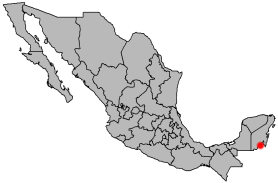
mapsize =
map_caption =
mapsize1 =
map_caption1 =
image_dot_
dot_mapsize =
dot_map_caption =
dot_x = |dot_y =
pushpin_
pushpin_label_position =
pushpin_map_caption =
pushpin_mapsize =
subdivision_type = Country
subdivision_name = MEX
subdivision_type1 = State
subdivision_name1 =Quintana Roo
subdivision_type2 = Municipality
subdivision_name2 = Othon P. Blanco
subdivision_type3 =
subdivision_name3 =
subdivision_type4 =
subdivision_name4 =
government_footnotes =
government_type =
leader_title =
leader_name =
leader_title1 =
leader_name1 =
leader_title2 =
leader_name2 =
leader_title3 =
leader_name3 =
leader_title4 =
leader_name4 =
established_title =
established_date =
established_title2 =
established_date2 =
established_title3 =
established_date3 =
area_magnitude =
unit_pref =
area_footnotes =
area_total_km2 =
area_land_km2 =
area_water_km2 =
area_total_sq_mi =
area_land_sq_mi =
area_water_sq_mi =
area_water_percent =
area_urban_km2 =
area_urban_sq_mi =
area_metro_km2 =
area_metro_sq_mi =
area_blank1_title =
area_blank1_km2 =
area_blank1_sq_mi =
population_as_of =2005
population_footnotes =
population_note =
population_total =4446
population_density_km2 =
population_density_sq_mi =
population_metro =
population_density_metro_km2 =
population_density_metro_sq_mi =
population_urban =
population_density_urban_km2 =
population_density_urban_sq_mi =
population_blank1_title =
population_blank1 =
population_density_blank1_km2 =
population_density_blank1_sq_mi =
timezone = CST
utc_offset = -6
timezone_DST =
utc_offset_DST =
latd=18 |latm=35 |lats= |latNS=N
longd=88 |longm=20 |longs= |longEW=W
elevation_footnotes =
elevation_m = 15
elevation_ft =
postal_code_type = Postal code
postal_code =
area_code =
blank_name =
blank_info =
blank1_name =
blank1_info =
website =
footnotes =Caderitas (coordinates: coord|18|35|N|88|20|W|) is a city on the east coast of the
Yucatán Peninsula inMexico .The city of Calderitas is situated on the western side of
Chetumal Bay , near the mouth of the Río Hondo. Because of its close proxiemty to the Caribbean coastline, it is vulnerable totropical cyclone s;Hurricane Janet andHurricane Dean , both Category 5 storms, made landfall near Calderitas in 1955 and 2007 respectively. This is a small but growing Mayan Village with a Mayor and a Mayan Council of Elders. The growth of Chetumal will influence this town greatly in a few years. The only local Beach is in this town as well as one opened Mayan Ruin and a boat ramp. [Wood Martinez Elisabet J. [http://www.local-gringos.com [Carrillo, Manuel. [http://ca.today.reuters.com/news/newsArticle.aspx?type=topNews&storyID=2007-08-21T114541Z_01_LAU663956_RTRIDST_0_NEWS-STORM-DEAN-COL.XML Dean pummels Mexican resorts] , Reuters Canada,2007-08-21 . Accessed2007-08-21 .]References
Wikimedia Foundation. 2010.