- Ballyferriter
Infobox Irish Place
name = Ballyferriter
gaeilge = Baile an Fheirtéaraigh
crest
motto =
map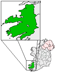
pin coords = left: 16px; top: 61px
north coord = 52.175195
west coord = 10.414009
irish grid = Q352044
area =
elevation =
province =Munster
county =County Kerry
town pop =
rural pop =
census yr =
web =
|Ballyferriter (official name: Baile an Fheirtéaraigh and sometimes also referred to in Irish as "An Buailtín") is a village in
County Kerry ,Ireland . It is located in the west of theCorca Dhuibhne (Dingle) peninsula which is aGaeltacht and according to the 2002 census, about 75% of the town's population speaks the Irish language on a daily basis. The village is named after the Norman-Irish Feiritéar family who settled inArd na Caithne in the late medieval period and of whom the seventeenth century poet and executed leader,Piaras Feiritéar , remains the most famous member. The older Irish name for the village "An Buailtín" "the little dairy place" is still used locally. The village lies at the base ofCroaghmarhin hill near Cuan Ard na Caithne (formerly also called Smerwick harbour) on theDingle peninsula, on regional road R559 which loops around the west of the peninsula, beginning and ending in An Daingean Town. It has three pubs: Tigh Uí Chatháin, Tigh Uí Mhurchú, Tigh an tSaorsaigh, and one hotel, [http://www.ceannsibealhotel.com/rooms.html Óstán Cheann Sibéal] (formerly Tigh Peig's). It also has a school, church, museum, and a Garda station. The village is alive with Irish students throughout the summer as courses are held in the local national school, with UCC owning a house there that facilitates year-long study for students at a higher level.Between Baile an Fheirtéaraigh and Cuan Ard na Caithne is Dún an Óir (the Fort of Gold), and
Iron Age promontory fort , which was the location of the Siege of Smerwick, an infamous massacre in1580 . The 600-strong Spanish and Italian "papal invasion" force who had come as part of theSecond Desmond Rebellion ofJames Fitzmaurice Fitzgerald were besieged and massacred by the English crown forces ofArthur Grey, 14th Baron Grey de Wilton .Under a placennames order in 2004, the Minister for the Gaeltacht,
Éamon Ó Cuiv declared that on maps and signage the Irish name, Baile an Fheirtéaraigh, must be used.
Wikimedia Foundation. 2010.