- Minonk, Illinois
-
Minonk City Country United States State Illinois County Woodford Elevation 747 ft (228 m) Coordinates 40°54′8″N 89°2′10″W / 40.90222°N 89.03611°W Area 1.4 sq mi (4 km2) - land 1.4 sq mi (4 km2) Population 2,168 (2000) Density 1,587.6 / sq mi (613 / km2) Timezone CST (UTC-6) - summer (DST) CDT (UTC-5) Postal code 61760 Area code 309 

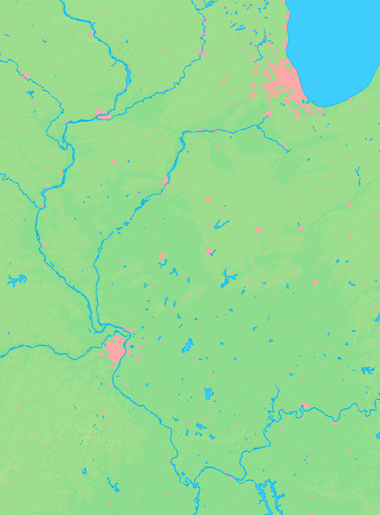
 Location of Minonk within Illinois
Wikimedia Commons: Minonk, Illinois Minonk is a city in Woodford County, Illinois, United States. The population was 2,168 at the 2000 census. It is part of the Peoria, Illinois Metropolitan Statistical Area.
Contents
Geography
Minonk is located at 40°54′8″N 89°2′10″W / 40.90222°N 89.03611°W (40.902357, -89.035992).[1]
According to the United States Census Bureau, the city has a total area of 1.4 square miles (3.6 km2), all of it land. Minonk is surrounded by some of the best farm land in the world. Corn and soybeans are staple crops.
Demographics
As of the census[2] of 2000, there were 2,168 people, 841 households, and 587 families residing in the city. The population density was 1,587.6 people per square mile (611.0/km²). There were 885 housing units at an average density of 648.1 per square mile (249.4/km²). The racial makeup of the city was 98.99% White, 0.05% African American, 0.05% Asian, 0.28% from other races, and 0.65% from two or more races. Hispanic or Latino of any race were 1.20% of the population.
There were 841 households out of which 31.9% had children under the age of 18 living with them, 57.9% were married couples living together, 9.2% had a female householder with no husband present, and 30.2% were non-families. 26.8% of all households were made up of individuals and 15.6% had someone living alone who was 65 years of age or older. The average household size was 2.50 and the average family size was 3.02.
In the city the population was spread out with 25.9% under the age of 18, 6.9% from 18 to 24, 27.5% from 25 to 44, 19.0% from 45 to 64, and 20.8% who were 65 years of age or older. The median age was 39 years. For every 100 females there were 91.4 males. For every 100 females age 18 and over, there were 86.0 males.
The median income for a household in the city was $44,028, and the median income for a family was $50,379. Males had a median income of $35,859 versus $22,500 for females. The per capita income for the city was $17,688. About 7.0% of families and 8.6% of the population were below the poverty line, including 12.9% of those under age 18 and 7.7% of those age 65 or over.
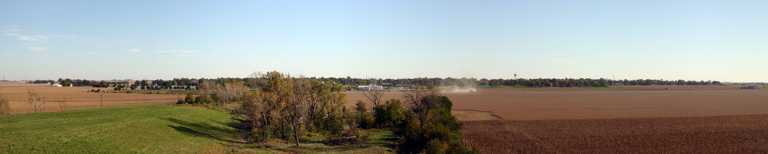
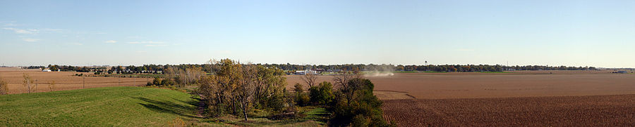 Panorama of Minonk from the north during Harvest 2006
History
The founding of Minonk corresponds with the construction of the Illinois Central Railroad. The Illinois Central Railroad main line was completed in 1854, and ran through Section Seven, which eventually became the City of Minonk. The plat of the town was first recorded on November 7, 1854.[3]
David Neal, an agent with the Illinois Central Railroad, is credited for naming the city. Local folklore provides varying accounts about the origins of the name “Minonk.” One version states that he originally named the area after a street in Boston, MA, where he owned property. A second story suggests that he changed the name of the settlement, originally referred to as “Marquette” on old French maps, to the Ojibwe word “Minonk,” meaning “a good place.” Minonk is the only city in the world with that name.[4]
Early settlers were attracted to Minonk by a variety of livelihoods. Many came to work on the railroad. Others settled in the area to farm on the abundant, rich farmland. However, coal mining was the leading industry in the early years of Minonk. The first coal mines were developed in the 1860s, and at one point employed over 300 men.[5] Two mines operated in Minonk: the first mine was located on the north edge of the city, and the second was situated a half-mile north of town.[6] The distinctive slag piles resulting from mine residue were referred to as “Jumbos” by local citizens. One slag heap currently remains on Minonk’s northern border.
In late 2011, a 75-turbine wind farm- that could deliver $360,000 in fees and permits for Woodford County- will start construction (another part of the project is in neighboring Livingston County, Illinois, with 25 towers). The plot of land was purchased by Navitas Energy Inc. in 2009. In 2010, its application to use the land as a wind farm was approved. After approval, the land was sold to Minonk Wind farm LLC.
Notes
- ^ "US Gazetteer files: 2010, 2000, and 1990". United States Census Bureau. 2011-02-12. http://www.census.gov/geo/www/gazetteer/gazette.html. Retrieved 2011-04-23.
- ^ "American FactFinder". United States Census Bureau. http://factfinder.census.gov. Retrieved 2008-01-31.
- ^ Schneider 1981, p. 1
- ^ Schneider 1981, p. 1
- ^ Schneider 1981, p. 87
- ^ Schneider 1981, pg. 87
References
Schneider, Alice Hayes. Tales from the Trees. Minonk, IL: Schneider, 1981.
External links
Municipalities and communities of Woodford County, Illinois Cities 
Villages Bay View Gardens | Benson | Congerville | Deer Creek‡ | Germantown Hills | Goodfield‡ | Kappa | Metamora | Panola | Peoria Heights‡ | Roanoke | Secor | Spring Bay | Washburn‡
Townships Unincorporated
communitiesLow Point | Oak Ridge | Spires | Woodford
Categories:- Cities in Illinois
- Populated places in Woodford County, Illinois
- Peoria metropolitan area

Wikimedia Foundation. 2010.