- Chaitén
-
For the volcano, see Chaitén Volcano.
Chaitén — Town and Commune — The town of Chaitén in 2007
Coat of armsLocation of Chaitén commune in Los Lagos Region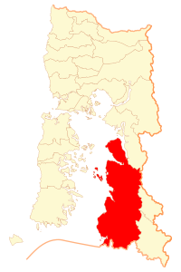 Location in Chile
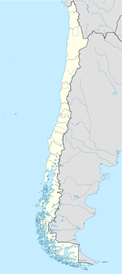
 Chaitén
Coordinates (city): 42°55′0″S 72°42′0″W / 42.916667°S 72.7°WCoordinates: 42°55′0″S 72°42′0″W / 42.916667°S 72.7°W Country Chile Region Los Lagos Province Palena Founded 1933 Evacuated May 2008 Government - Type Municipality - Alcalde José Miguel Fritis Area - Town and Commune 8,471 km2 (3,270.7 sq mi) Population (2002 census) - Town and Commune 7,182 - Density 0.8/km2 (2.2/sq mi) - Urban 4,065 Time zone CLT [1] (UTC-4) - Summer (DST) CLST [2] (UTC-3) postal code Area code(s) country 56 + city = ? Chaitén (
 /tʃaɪˈtɛn/, chahy-ten) is a Chilean town, commune and former capital of the Palena Province in Los Lagos Region. The town is located north of the mouth of Yelcho River, on the east coast of the Gulf of Corcovado. The town is strategically located close to the northern end of the Carretera Austral where the highway goes inland.
Contents
Evacuation
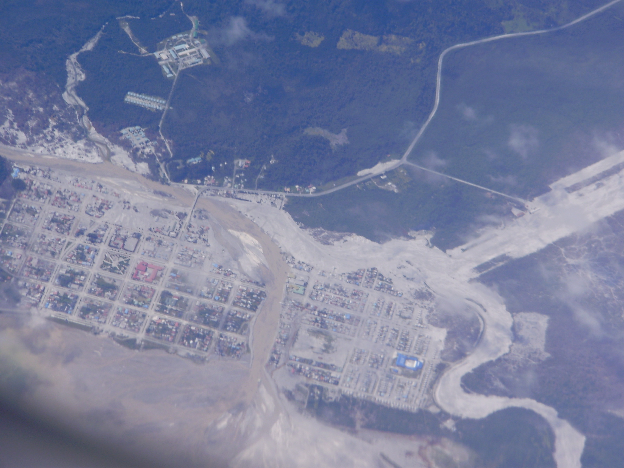
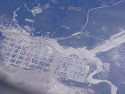 The river's new course shown in the center of the image.

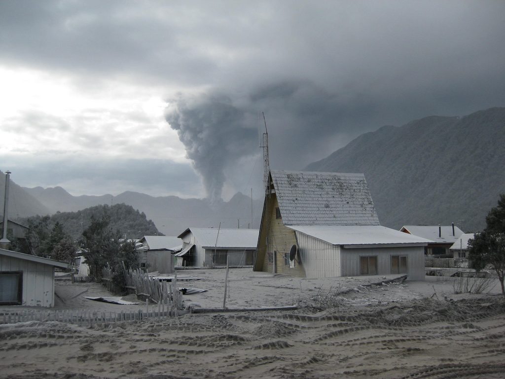
The town was evacuated in May 2008 when the Chaitén volcano erupted for the first time in more than 9,000 years.[3][4] The eruption, which commenced May 2, became more violent on May 5,[5] throwing up a high plume of ash and sulfurous steam that rose to 19 miles (31 km), from which ashfall drifted across Patagonia, and over the Atlantic Ocean.[6] During 2005 small earthquakes occurred below Chaiten and the nearby Liquiñe-Ofqui fault zone.[7]
The town was completely flooded on May 12, 2008 after a lahar caused the banks of the Blanco River to overflow about 200 m on each side.[8] Over the subsequent weeks, the river excavated a new course through Chaitén, completely destroying a significant part of it by July 2008. (At the time of writing, this process is still ongoing; it is unclear how extensive the damage will ultimately be.) Some defensive work has been undertaken by the government, but they ultimately decided to abandon the town, relocating and compensating all residents.[9] The provincial capital was provisionally moved to Futaleufú after the eruption breakout, but the capital shift was later on declared permanent. The future of the town has become a matter of political controversy in Chile.
Reconstruction of Chaitén
On February 25, 2009 the government announced plans to rebuild Chaitén 10 km north of its current location in a coastal place known as Santa Bárbara or "Fandango Norte."[10] On March 3, 2009 construction work on the new town's administrative facilities started.[11]
On April 9, 2011, president Sebastián Piñera announced a program to rebuilt the town on its existing northern area, reversing plans by the previous administration to move the town to a different location further north.[12]
Nearby attractions
Nearby attractions include:
- Corcovado National Park, which includes Corcovado volcano.
- Pumalín Park, which includes Michinmahuida volcano.
- Yelcho Lake
- Carretera Austral
References
- ^ "Chile Time". WorldTimeZones.org. http://www.world-time-zones.org/zones/chile-time.htm. Retrieved 26 September 2010.
- ^ "Chile Summer Time". WorldTimeZones.org. http://www.world-time-zones.org/zones/chile-summer-time.htm. Retrieved 26 September 2010.
- ^ The Global Volcanism Program reports that previously assessed radiocarbon dating of the last lava flow from Chaitén has suggested that the volcano last erupted in 7420 BC, plus or minus 75 years. (NASA, "Earth Observatory Natural Hazards)
- ^ Naranjo, José A.; José A. Naranjo, Charles R. Stern (December 2004). "Holocene tephrochronology of the southernmost part (42°30'-45°S) of the Andean Southern Volcanic Zone". Revista Geológica de Chile (Santiago, Chile: Servicio Nacional de Geología y Minería) 31 (2): 225–240. doi:10.4067/S0716-02082004000200003. http://www.scielo.cl/scielo.php?pid=S0716-02082004000200003&script=sci_arttext#img06. Retrieved 2008-05-07.
- ^ (Times online) "4,000 evacuated as volcano blast meets storm in the Chilean sky" May 6, 2008.
- ^ NASA, "Earth Observatory Natural Hazards plume visible from space]
- ^ Lange, D.; Cembrano, J.; Rietbrock, A.; Haberland, C.; Dahm, T. and Bataille, K (April 2008). "First seismic record for intra-arc strike-slip tectonics along the Liquiñe-Ofqui fault zone at the obliquely convergent plate margin of the southern Andes,". Tectonophysics (Tectonophysics) 455 (1–4): 14. doi:10.1016/j.tecto.2008.04.014.
- ^ Global Volcanism Program | Chaitén | SI / USGS Weekly Volcanic Activity Reports
- ^ La Nacion "Gobierno no reconstruirá Chaitén y prepara relocalización", 2009 Jan 30
- ^ [1][dead link]
- ^ "Comienzan los trabajos para la construcción de centro cívico de nueva Chaitén". Latercera.com. 2010-02-25. http://latercera.com/contenido/654_105748_9.shtml. Retrieved 2010-03-01.
- ^ Piñera oficializa refundación de Chaitén en sector norte de la ciudad, El Mercurio, April 9, 2011.
< Communes and municipalities in Los Lagos Region > Osorno Province 
Llanquihue Province Calbuco · Cochamó · Fresia · Frutillar · Llanquihue · Maullín · Los Muermos · Puerto Montt · Puerto VarasChiloé Province Palena Province Categories:- Communes of Chile
- Capitals of Chilean provinces
- Populated places established in 1933
- Ghost towns in South America
- Former populated places in Chile
- Populated places in Palena Province


Wikimedia Foundation. 2010.