Shard Bridge

Shard Bridge

Infobox_Bridge
bridge_name = Shard Bridge


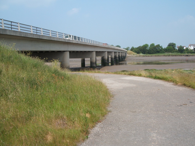
caption = A view of Shard Bridge from the southern banks of the River Wyre
official_name =
carries = A588
crosses = River Wyre
locale = SingletonHambleton, Lancashire, England
maint = Lancashire County Council
id =
design = Segmental
mainspan = convert|714|ft|m|0
length =
width =
height =
clearance =
below =
traffic =
open = 1864
closed =
toll =
map_cue =
map_

map_text =
map_width =
coordinates = coord|53.8620|N|02.9625|W|type:bridge
lat=
long=
Location map
Lancashire
label=
align=left
background=white
lat= 53.862
long=-2.9625
caption=
"Location of Shard Bridge within Lancashire"

float=right
width=237

Shard Bridge is a bridge in the English county of Lancashire. It spans the River Wyre, connecting Singleton, on the southern side of the river, to Hambleton, on its northern side (known locally as "Over Wyre"), carrying both automotive and pedestrian traffic of Shard Road (the A588).

The original bridge was built in 1864, [ [http://www.btinternet.com/~stephen.yarwood/river_wyre.htm Poulton Le Fylde ] ] and it went on to replace a ferry service between Stanah and further downstream to the west.

The first of two modern incarnations of the bridge was rebuilt in 1993, moving the structure a few yards downstream.

Formerly a toll bridge, Shard Bridge is now a free municipal crossing. [ [http://www.fredmoor.com/thefylde/ofylde.htm TheFylde.com] ]

Notes

References

The 1988 New Shard Bridge scheme by Lancashire County Council:
* [http://www.opsi.gov.uk/SI/si1991/Uksi_19912823_en_1.htm Page 1]
* [http://www.opsi.gov.uk/SI/si1991/Uksi_19912823_en_2.htm Page 2]
* [http://www.opsi.gov.uk/SI/si1991/Uksi_19912823_en_3.htm Page 3]
* [http://www.opsi.gov.uk/SI/si1991/Uksi_19912823_en_4.htm Page 4]

External links

* [http://www.btinternet.com/~stephen.yarwood/river_wyre.htm A photo of the original Shard Bridge and the Wardley's ferry]


Wikimedia Foundation. 2010.

Игры ⚽ Поможем решить контрольную работу

Look at other dictionaries:

  • Shard London Bridge — Localisation Localisation 32 London Bridge Street (Londres) Coordonnées …   Wikipédia en Français

  • Shard London Bridge — Shard London Bridge …   Deutsch Wikipedia

  • Shard London Bridge — «Shard London Bridge» Местонахождение Лондон,   …   Википедия

  • Shard London Bridge — Edificio Coste £450 millones Localización …   Wikipedia Español

  • Shard — may refer to:* Sherd, a fragment of pottery, glass or stone * Elytron, a forewing found on some insect species * Shard London Bridge, a planned skyscraper * Meth, another word for the drug meth, reffering to the shard like crystals Popular… …   Wikipedia

  • Shard London Bridge — Infobox Skyscraper building name= Shard London Bridge status= Site under going Demolition previous building= year built= 2009 2012 surpassed by building= year highest= year end= location= 32 London Bridge Street, London, UK roof= 306 metres… …   Wikipedia

  • The Shard — Координаты: 51°30′16″ с. ш. 0°05′12″ з. д. / 51.504444° с. ш. 0.086667° з. д.  …   Википедия

  • London Bridge Tower — Der Shard London Bridge (vormals London Bridge Tower, auch Shard of Glass) ist ein in London geplanter Wolkenkratzer, der bei seiner Fertigstellung nach jetzigem Stand mit 310 Metern nach dem Moskauer Hochhaus Federazija das zweithöchste Gebäude… …   Deutsch Wikipedia

  • A Single Shard — Infobox Book name = A Single Shard title orig = translator = image caption = author = Linda Sue Park illustrator = cover artist = Jean and Mon sien Tseng country = United States language = English series = genre = Historical novel publisher =… …   Wikipedia

  • London Bridge station — Infobox London station name = London Bridge manager = Network Rail zone = 1 borough = Southwark locale = London Bridge start = 14 December 1836 platforms = 15 railcode = LBG railexits0405 = 37.020 railexits0506 = 37.416 railexits0607 = 47.577… …   Wikipedia

Share the article and excerpts

Direct link
Do a right-click on the link above
and select “Copy Link”