- Meols Hall
-
Coordinates: 53°39′25″N 2°57′43″W / 53.657°N 2.962°W
Meols Hall 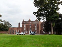
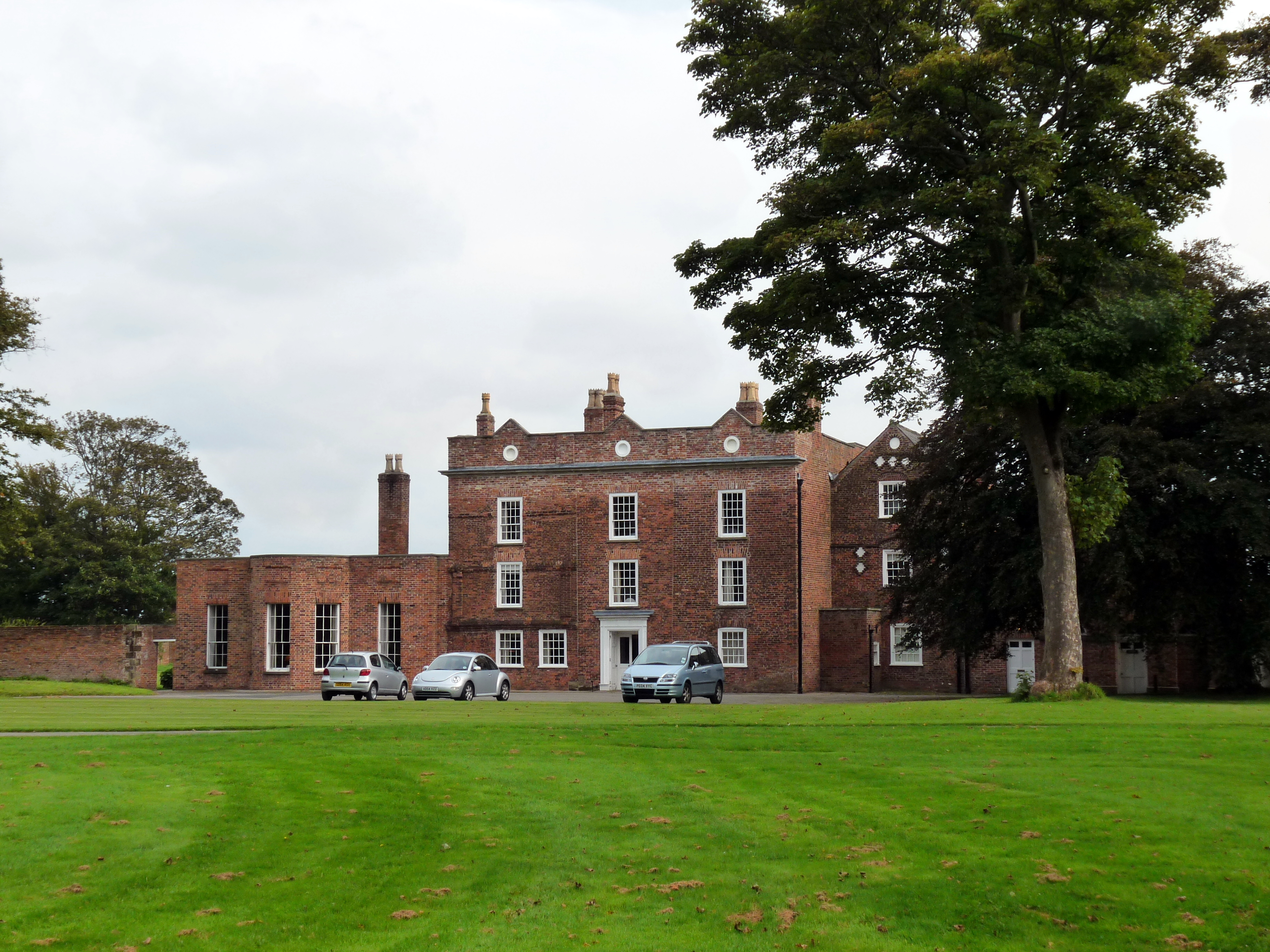
Meols Hall, September 2008General information Type Manor house Location Churchtown, Merseyside Design and construction Architect Roger Fleetwood-Hesketh Meols Hall is a historical manor house in Churchtown, Merseyside, dating from the 12th century but largely rebuilt in by Roger Fleetwood-Hesketh in the 1960s.
Contents
History
Meols Hall dates back to the late 12th century, when the manor was granted to Robert de Coudray of Penwortham. The manor has since passed down through marriage and inheritance, and in the 16th century became part of the property of a branch of the Heskeths of Rufford. Much of the old house was demolished in the mid 18th century, reducing the building to its mid 17th century core and a wing dating from c. 1695. Meols Hall was subsequently used as a farmhouse, until the family of Charles Hesketh took residence in 1919. Modest additions were made to the house in 1938, but the main reconstruction work was carried out between 1960-64 by Roger Fleetwood-Hesketh to his own design. This included the three storeyed red brick east front built in the style of Francis Smith of Warwick, and used stonework from Lathom House, rescued as it was about to be dumped in a disused Liverpool dock.[1]
Meols Hall today
Meols Hall has been acclaimed as "one of the most convincing country houses" constructed since World War II, and is a grade II* listed building.[2] The Hall is open to the public for guided tours on spring bank holiday Mondays and between 20 August and 14 September annually.from 1.30 pm to 5.30 pm. Last entries at 5pm.[3]
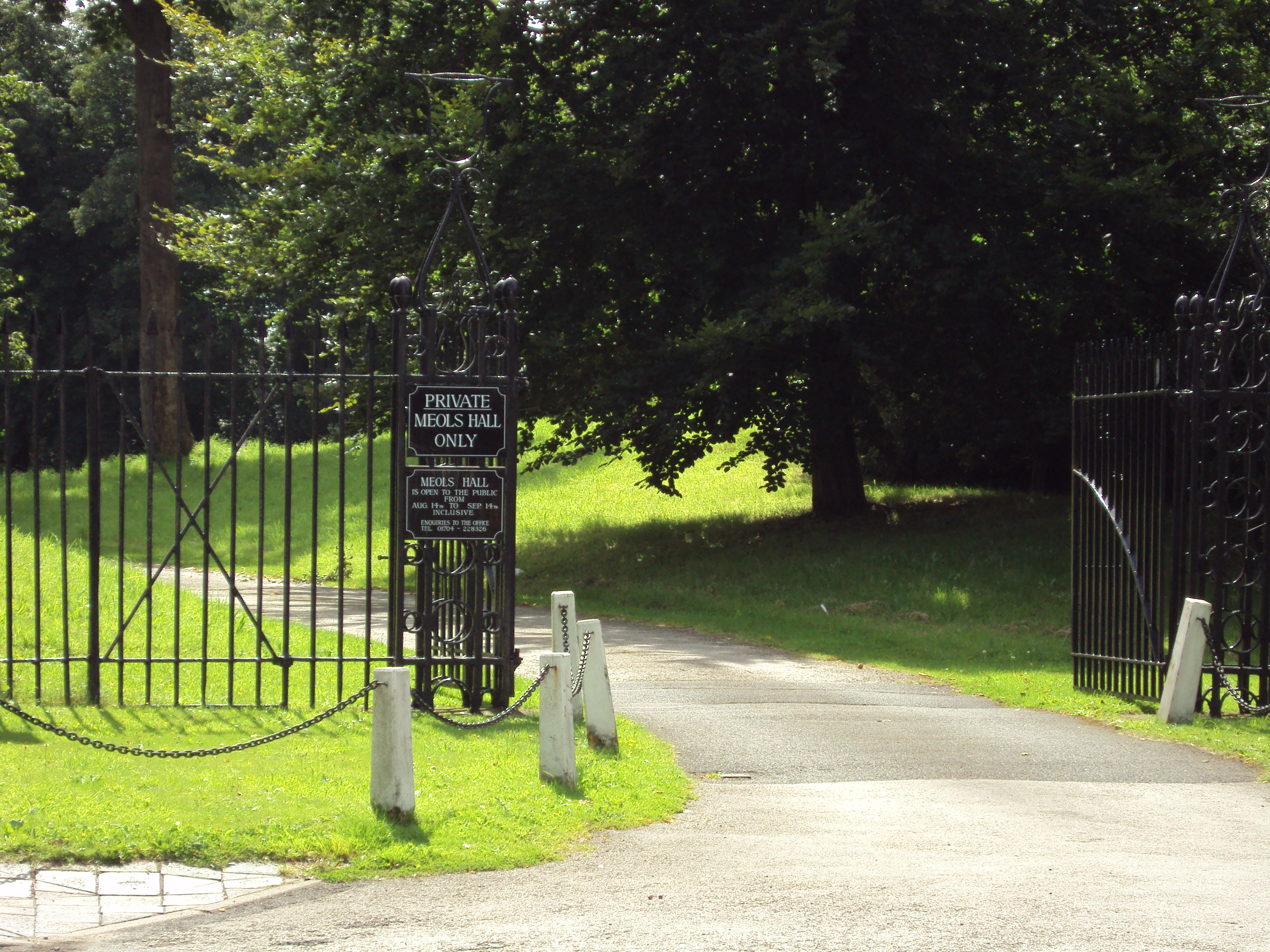
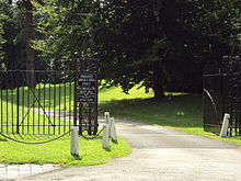 Meols Hall Entrance, Botanic Road
References
- ^ Robinson, John Martin (1991). A Guide to the Country Houses of the North-West. Constable. pp. 220–221. ISBN 0-09-469920-8.
- ^ "Meols Hall, Botanic Road". Images of England. English Heritage. http://www.imagesofengland.org.uk/details/default.aspx?id=478940. Retrieved 2008-10-17.
- ^ "Events". Meols Hall. http://www.meolshall.com/events.htm. Retrieved 2008-10-17.[dead link]
External links
Categories:- Buildings and structures in Sefton
- Grade II* listed buildings in Merseyside
- Country houses in Merseyside
- Merseyside building and structure stubs
Wikimedia Foundation. 2010.