Nino Konis Santana National Park

Nino Konis Santana National Park
IUCN Category II (National Park)
LocationEastTimor.svg
East Timor with the park at the far eastern tip
Location East Timor
Nearest city Tutuala
Coordinates 8°27′00″S 127°20′00″E / 8.45°S 127.3333333°E / -8.45; 127.3333333Coordinates: 8°27′00″S 127°20′00″E / 8.45°S 127.3333333°E / -8.45; 127.3333333
Area 1,236 km²
Established 2007
Governing body Department of Protected Areas and National Parks, East Timor
A mountain near Tutuala, Nino Konis Santana National Park

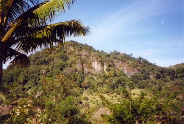
Nino Konis Santana National Park is East Timor's first national park. It was declared on August 3, 2007 and includes over 1,236 square kilometres of land. It links three important bird areas; Lore, Monte Paitchau and Lake Iralalara, and Jaco Island. The park also includes 556 km² of the Coral Triangle, an underwater area which supposedly contains the world's greatest diversity of both coral and coral reef fish. Some of the rare birds protected by this park are the critically endangered Yellow-crested Cockatoo, the endemic Timor Green-pigeon, the endangered Timor Imperial-pigeon, and the vulnerable Timor Sparrow. The park is named in honor of Nino Konis Santana, a former commander of FALANTIL, the armed forces of the independence movement who was born in Tutuala, a village within the borders of the national park.

References


Wikimedia Foundation. 2010.

Игры ⚽ Нужно решить контрольную?

Look at other dictionaries:

  • Nino Konis Santana Nationalpark — Eine Fatu, eine für Timor typische steile Klippe nahe Tutuala …   Deutsch Wikipedia

  • Parc national Nino Konis Santana — Fatu (affleurement rocheux) à proximité de Tutuala, dans le Parc national Nino Konis Santana. Identifiant 352708 Pays …   Wikipédia en Français

  • environment — environmental, adj. environmentally, adv. /en vuy reuhn meuhnt, vuy euhrn /, n. 1. the aggregate of surrounding things, conditions, or influences; surroundings; milieu. 2. Ecol. the air, water, minerals, organisms, and all other external factors… …   Universalium

  • East Timor — Democratic Republic of Timor Leste Repúblika Demokrátika Timór Leste[1] (Tetum) …   Wikipedia

  • List of East Timor-related topics — This is a list of topics related to East Timor. Those interested in the subject can monitor changes to the pages by clicking on Related changes in the sidebar.East Timor* East TimorBuildings and structures in East TimorAirports in East Timor*… …   Wikipedia

  • Jaco (East Timor) — Jaco (also sometimes written as Jako) is an island in the Lesser Sunda Islands. It lies across from the easternmost point of the island of Timor, Kap Cutcha . Its geographical coordinates are 8° 27 S and 127° 20 E. Politically it is part of the… …   Wikipedia

  • Lautém (Distrikt) — Distrikt von Lautém Daten Hauptstadt …   Deutsch Wikipedia

  • Bevölkerung Osttimors — Repúblika Demokrátika Timór Loro Sa e (Tetum) República Democrática de Timor Leste (port.) Demokratische Republik Timor Leste …   Deutsch Wikipedia

  • Demokratische Republik Osttimor — Repúblika Demokrátika Timór Loro Sa e (Tetum) República Democrática de Timor Leste (port.) Demokratische Republik Timor Leste …   Deutsch Wikipedia

  • Demokratische Republik Timor-Leste — Repúblika Demokrátika Timór Loro Sa e (Tetum) República Democrática de Timor Leste (port.) Demokratische Republik Timor Leste …   Deutsch Wikipedia

Share the article and excerpts

Direct link
Do a right-click on the link above
and select “Copy Link”