- De La Savane (Montreal Metro)
-
 Montreal Metro Station
Borough Côte-des-Neiges–Notre-Dame-de-Grâce City Montreal Opened 9 January 1984 Line  Orange Line
Architect Guy de Varennes & Almas Mathieu Artist Guy de Varennes & Almas Mathieu, Maurice Lemieux Platform Depth 19.4 metres Rank 15th deepest Traffic 700,714 entrances in 2006 Rank Least busy Interstation
Distance1281.69 metres to Du Collège
786.70 metres to Namur
Address of
Entrances8261, boul. Décarie Nearby Main
IntersectionsDecarie Boulevard / de Sorel Street [1]
De La Savane is a station on Orange Line of the Montreal Metro rapid transit system, operated by the Société de transport de Montréal (STM). It is located in the Côte-des-Neiges area of the borough of Côte-des-Neiges–Notre-Dame-de-Grâce in Montreal, Quebec, Canada [2] De la Savana Metro Station opened on January 9, 1984.Contents
Overview
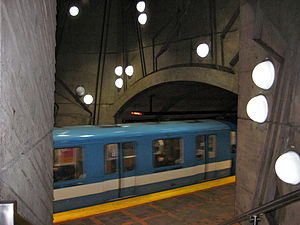
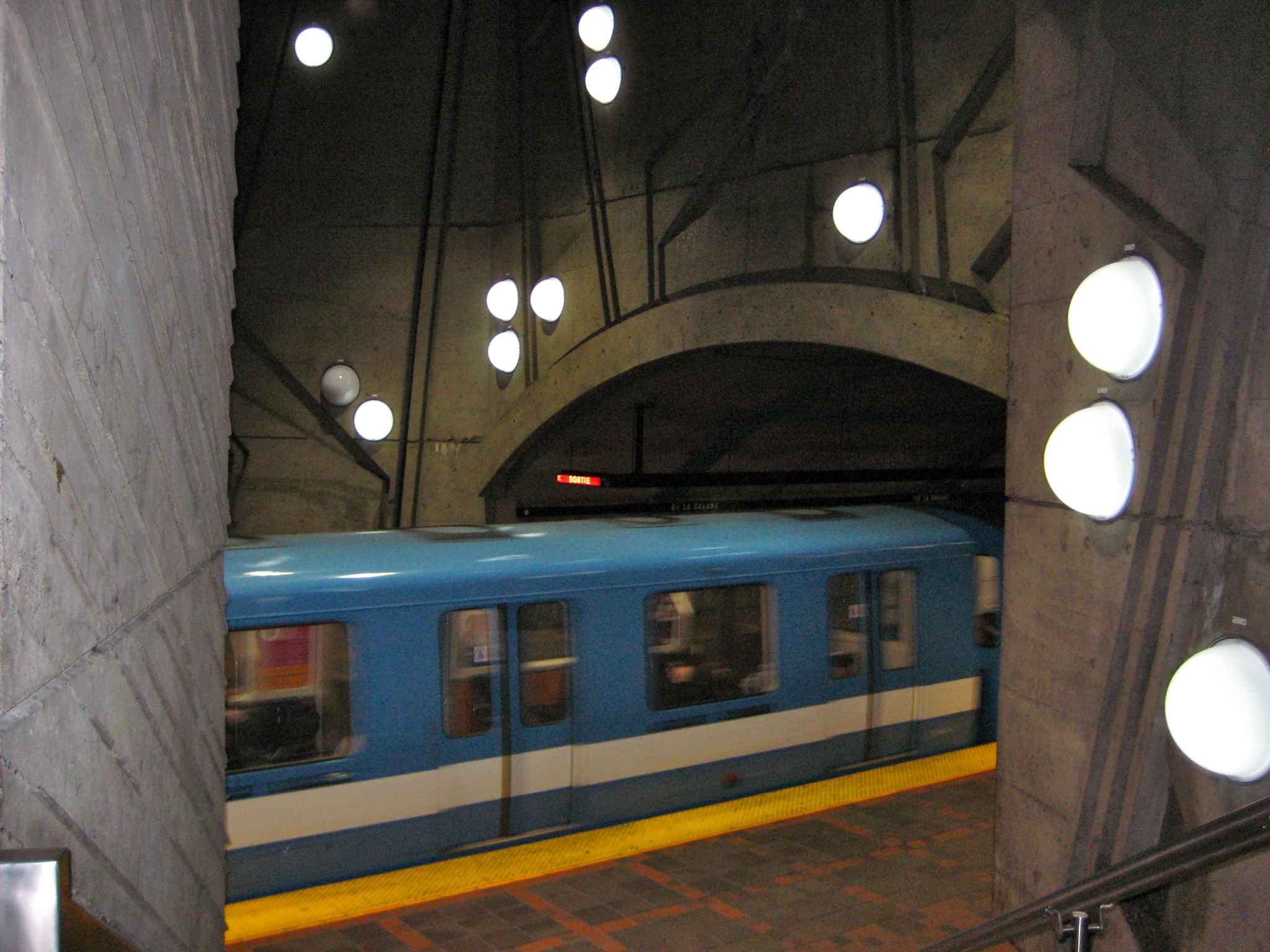
 De La Savane Station
The station is a normal side platform station with an entrance at the north end. It was planned in such a way as to allow an additional entrance to be built on the other side of the Décarie Autoroute, but this has not yet happened. As it is the station with the least number of passengers (as of 2002[update]), a redevelopment plan for the area is under discussion.
The station was designed by Guy de Varennes and Almas Mathieu. Its artworks include mural treatments in the entrance, mezzanine, and platforms by the architects, as well as a large metal sculpture by Maurice Lemieux, entitled Calcite, affixed to the wall of the mezzanine and illuminated by a light shaft.
Origin of the name
This station is named for the rue de la Savane, which has been known by that name since 1778 and was no doubt named for a nearby prairie or swamp (named savane in Quebec French).
Connecting bus routes
Main article: Société de transport de MontréalMain article: List of Montreal Bus RoutesRoute Service Times Map Schedule Société de transport de Montréal  17 Décarie
All-day Map Schedule  368 Mont Royal
Overnight Map Schedule 371 DécarieOvernight Map Schedule 376 Pierrefonds/DowntownOvernight Map Schedule 382 Pierrefonds/Saint-CharlesOvernight Map Schedule Nearby points of interest
- Décarie Autoroute
- Metropolitan Autoroute
- Baron de Hirsch Jewish Cemetery
- Centre commercial VMR
- Centre d'emploi du Canada
References
External links
- De La Savane station - official web page
- De La Savane metro station geo location
- Montreal by Metro, metrodemontreal.com
- 2008 STM System Map
- Metro Map
Line 1 Green Angrignon • Monk • Jolicoeur • Verdun • De L'Église • LaSalle • Charlevoix • Lionel-Groulx • Atwater • Guy-Concordia • Peel • McGill • Place-des-Arts • Saint-Laurent • Berri-UQAM • Beaudry • Papineau • Frontenac • Préfontaine • Joliette • Pie-IX • Viau • Assomption • Cadillac • Langelier • Radisson • Honoré-BeaugrandLine 2 Orange Côte-Vertu • Du Collège • De La Savane • Namur • Plamondon • Côte-Sainte-Catherine • Snowdon • Villa-Maria • Vendôme • Place-Saint-Henri • Lionel-Groulx • Georges-Vanier • Lucien-L'Allier • Bonaventure • Square-Victoria • Place-d'Armes • Champ-de-Mars • Berri-UQAM • Sherbrooke • Mont-Royal • Laurier • Rosemont • Beaubien • Jean-Talon • Jarry • Crémazie • Sauvé • Henri-Bourassa • Cartier • De La Concorde • MontmorencyLine 4 Yellow Line 5 Blue Snowdon • Côte-des-Neiges • Université-de-Montréal • Édouard-Montpetit • Outremont • Acadie • Parc • De Castelnau • Jean-Talon • Fabre • D'Iberville • Saint-MichelCoordinates: 45°29′57.29″N 73°39′35.63″W / 45.4992472°N 73.6598972°W
Categories:- Montreal Metro Orange Line
- Railway stations opened in 1984

Wikimedia Foundation. 2010.