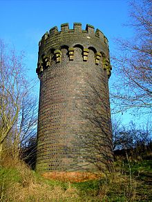
Chipping Sodbury Tunnel

Chipping Sodbury Tunnel

Chipping Sodbury Tunnel sits on the South Wales Main Line. It was constructed around 1900 for the South Wales and Bristol Direct Railway and runs some 2½ miles (4 km) west of Badminton railway station and Chipping Sodbury Yard.

The tunnel is constructed with an arch brick lining and measures some 27'6" across and 20'9" high. It slopes at a 1:300 gradient from Badminton falling in a westerly direction towards Chipping Sodbury.

The tunnel is prone to flooding and it is estimated that the route via the tunnel is closed an average of 24 times per annum, resulting in the cancellation and diversion of 50 passenger services and 40 freight services.

Coordinates

External links


Wikimedia Foundation. 2010.

Игры ⚽ Нужно сделать НИР?

Look at other dictionaries:

  • Chipping Sodbury — Coordinates: 51°32′17″N 2°23′38″W / 51.538°N 2.394°W / 51.538; 2.394 …   Wikipedia

  • Old Sodbury — Coordinates: 51°32′01″N 2°21′22″W / 51.533601°N 2.356147°W / 51.533601; 2.356147 …   Wikipedia

  • South Wales Main Line — Swindon–Swansea Severn Tunnel Streckenlänge: 114 km Spurweite: 1435 mm (Normalspur) Stromsystem: (bis 2017)  …   Deutsch Wikipedia

  • Южно-Уэльская главная линия — South Wales Main Line, Prif Linell De Cymru …   Википедия

  • South Gloucestershire — is a unitary district in the ceremonial county of Gloucestershire in South West England.The district was created in 1996, when the county of Avon was abolished, by the merger of former area of the districts of Kingswood and Northavon. The… …   Wikipedia

  • New Passage — is a small hamlet in South Gloucestershire, England located on the banks of the Severn estuary near the village of Pilning. It derives its name from the ferry service which operated between there and South Wales before the late 19th century, when …   Wikipedia

  • Over, South Gloucestershire — This article is about the village in South Gloucestershire near Bristol. For the village in central Gloucestershire near Gloucester, see Over, Gloucestershire. Coordinates: 51°32′24″N 2°35′46″W /  …   Wikipedia

  • Wickwar — infobox UK place country = England official name= Wickwar population= latitude= 51.59523 longitude= 2.39992 unitary england= South Gloucestershire lieutenancy england= Gloucestershire region= South West England constituency westminster= Northavon …   Wikipedia

  • Cromhall — is a village in South Gloucestershire, England. It lies between Bagstone and Charfield on the B4058. It also borders Leyhill Cromhall is about 1 mile from Falfield on the A38 Tortworth turn off. Tortworth Estate is owned by Lord Morton, Earl of… …   Wikipedia

  • Monarch's Way — Waymark on a Public Footpath Length 615 miles (990 km) Location Warwickshire, Worcestershire, Staffordshire, Sussex, Gloucesters …   Wikipedia

Share the article and excerpts

Direct link
Do a right-click on the link above
and select “Copy Link”