- Ouanda Djallé
-
Ouanda Djallé 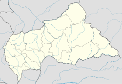
 Ouanda Djallé
Coordinates: 8°54′N 22°48′E / 8.9°N 22.8°ECoordinates: 8°54′N 22°48′E / 8.9°N 22.8°E Country  Central African Republic
Prefecture Vakaga Government – Sub-prefect N/A Elevation 697 m (2,290 ft) Population (2003) – Total 2,839 Ouanda Djallé is a sub-prefecture and town in the prefecture of Vakaga in the Central African Republic. It is located 130 km south of Birao. By population it is one of the smallest sub-prefectures in the country (only Bambouti and Djémah are smaller).
Contents
History
The settlement was founded by Captain Souclier in December 1912. In May 1913, it became a subdivision comprising the area of Birao, and during the following years it came to be a part of the sub-divisions of Haute-Kotto and Dar-Kouti Oriental. In 1914 the town was temporarily abandoned after destruction by fire. After independence the town became a control post within the autonomous sub-prefecture of Birao. The current division was finally imposed in November 1964.[1]
On 10 November 2006, rebels from the previously unknown Union of Democratic Forces for Unity seized Ouanda Djallé. They had started their offensive two weeks earlier at the capital of the Vakaga prefecture, Birao, where 50-60 rebels managed to chase away 60 government soldiers posted in the city. They then took nine vehicles, including two pick-ups mounted with 14.5 mm heavy machine guns that were left by the government troops and continued south towards Ouanda Djallé. During the following weeks the troops seized not only Ouanda Djallé, but also neighbouring sub-prefectures Birao, N'Délé and Ouadda. All of these towns were finally taken back by the Central African Republic military force, supported by French troops on 27 November. At the time of defeat, the rebel soldiers were in Mouka, on their way to Bria.[2]
Geography and climate
During the last 20 years the Sahel area has spread closer and closer to Ouanda Djallé. In the mid-1990s, the border was said to be half-way between Birao and Ouanda Djallé. Ouanda Djallé is located on the Bongo Massif and its peak Mont Toussoro (1330m) is east of Ouanda Djallé.
The town is located close to the Sudanese border, about 75 km from South Darfur.
Transport
The town is a bit isolated from the rest of the country. Most people live in the western parts of the Central African Republic, and this town is located far from the capital, dependent on bad roads. It has an airfield, Ouanda Djallé Airport.
Notes and references
Categories:- Sub-prefectures of the Central African Republic
- Populated places in the Central African Republic
- Populated places established in 1912
- French Equatorial Africa

Wikimedia Foundation. 2010.