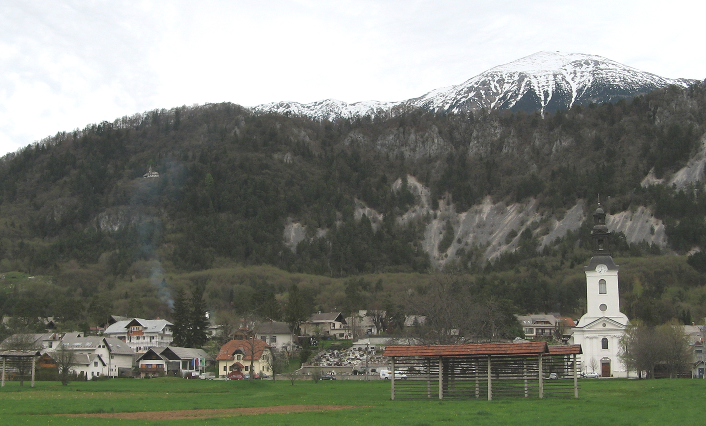
- Breznica (Žirovnica)
Infobox Settlement
official_name = Breznica
other_name =
native_name =
nickname =
settlement_type =
motto =
imagesize = 250px
image_caption =
flag_size =
image_
seal_size =
image_shield =
shield_size =
image_blank_emblem =
blank_emblem_type =
blank_emblem_size =
mapsize =
map_caption =
mapsize1 =
map_caption1 =
image_dot_
dot_mapsize =
dot_map_caption =
dot_x = |dot_y =
pushpin_
pushpin_label_position =bottom
pushpin_map_caption = Location in Slovenia
subdivision_type = Country
subdivision_name =
subdivision_type1 = Region
subdivision_name1 =Upper Carniola
subdivision_type2 = Municipality
subdivision_name2 =Žirovnica
subdivision_type3 =
subdivision_name3 =
subdivision_type4 =
subdivision_name4 =
leader_name =
leader_title1 =
leader_name1 =
leader_title2 =
leader_name2 =
leader_title3 =
leader_name3 =
leader_title4 =
leader_name4 =
established_title =
established_date =
established_title2 =
established_date2 =
established_title3 =
established_date3 =
area_magnitude =
area_footnotes =
area_total_km2 =
area_land_km2 =
area_water_km2 =
area_total_sq_mi =
area_land_sq_mi =
area_water_sq_mi =
area_water_percent =
area_urban_km2 =
area_urban_sq_mi =
area_metro_km2 =
area_metro_sq_mi =
area_blank1_title =
area_blank1_km2 =
area_blank1_sq_mi =
population_as_of =2002
population_footnotes =
population_note =
population_total =459
population_density_km2 =
population_density_sq_mi =
population_metro =
population_density_metro_km2 =
population_density_metro_sq_mi =
population_urban =
population_density_urban_km2 =
population_density_urban_sq_mi =
population_blank1_title =Ethnicities
population_blank1 =
population_blank2_title =Religions
population_blank2 =
population_density_blank1_km2 =
population_density_blank1_sq_mi =
timezone =
utc_offset =
timezone_DST =
utc_offset_DST =
latd= 46|latm= 23|lats=50 |latNS=N
longd=14|longm=9|longs=13 |longEW=E
elevation_footnotes =
elevation_m = 545
elevation_ft =
postal_code_type =
postal_code =
area_code =
blank_name =
blank_info =
blank1_name =
blank1_info =
website =
footnotes = [ [http://www.stat.si/eng/index.asp Statistical Office of the Republic of Slovenia] ]Breznica is one of ten villages in the
Žirovnica municipality in theUpper Carniola region ofSlovenia .It is where the municipal administration is based and is also the location of the
parish church dedicated to the Virgin Mary. The building of the current parish church began in1819 and its architect was a certain Blasio Zamolo from Gemona , whose signature can be found above the main entrance. The church was extensively renovated in1993 . In front of the church stands a monument to those who fell inWorld War I designed by the architectJože Plečnik .Most of the village has developed on the slopes of the Reber range, leaving open fields towards the south and east. Towards the west the the built-up area has extended right to
Zabreznica .Notes
External links
* [http://www.geopedia.si/#L410_F10097746_T105_b4_x434666.40599999995_y139888.5_s15 Breznica at Geopedia]
* [http://www.zirovnica.eu/ Žirovnica Tourist Association site]
Wikimedia Foundation. 2010.

