Kercaszomor

Kercaszomor

Infobox Settlement
subdivision_type = Country
subdivision_name = HUN
timezone=CET
utc_offset=+1
timezone_DST=CEST
utc_offset_DST=+2

|official_name=Kercaszomor


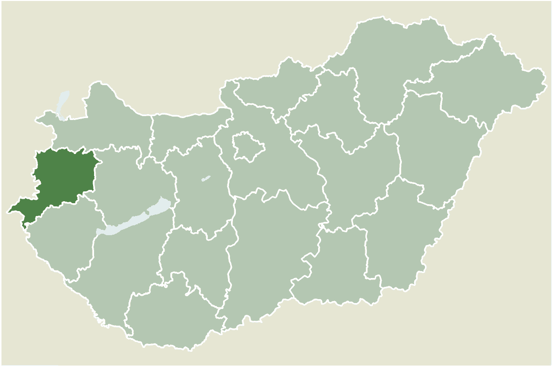
center|thumb|275px|Location of Vas county in HungaryIt has very little water access and is in the middle of land no large bodys of water around it.| It has very little water access and is in the middle of land no large bodys of water around it.subdivision_type1=County
subdivision_name1=Vas
area_total_km2=12.87
population_total=214
population_as_of=2004
population_density_km2=16.62
postal_code_type=Postal code
postal_code=9945
area_code=94
pushpin_

pushpin_label_position =
pushpin_map_caption =Location of Kercaszomor
pushpin_mapsize =
latd=46.78810
longd=16.34396

Kercaszomor is a village in Vas county, Hungary.

External links

* [http://www.terkepcentrum.hu/index.asp?go=map&tid=26596 Street map (Hungarian)]


Wikimedia Foundation. 2010.

Игры ⚽ Нужно сделать НИР?

Look at other dictionaries:

  • Kercaszomor — Administration …   Wikipédia en Français

  • Kerca Bio Farm — (Kercaszomor,Венгрия) Категория отеля: Адрес: 9945 Kercaszomor, Fö utca 99., Венгрия …   Каталог отелей

  • Vas County — Infobox Hungarian county name =Vas region =Western Transdanubia seat = Szombathely area = 3336 population = 261,900 density = 78 cities = 216Vas (German: Eisenburg , Slovenian Železna županija ) is the name of an administrative county (comitatus… …   Wikipedia

  • Szentgotthárd — City centre with the Rába River …   Wikipedia

  • Csepreg — Sea …   Wikipedia

  • Őriszentpéter — Coat of arms Country …   Wikipedia

  • List of places in Hungary whose names were changed — A list of settlements in Hungary whose name was changed during the 19 20th century. This list contains only settlements within the present day borders of Hungary.{| class= wikitable bgcolor=#cccccc! Original name !! New name !! Period… …   Wikipedia

  • Friede von Trianon — Karte der territorialen Aufteilung Österreich Ungarns nach den Pariser Vorortverträgen Ethnische Karte Gro …   Deutsch Wikipedia

  • Frieden von Trianon — Karte der territorialen Aufteilung Österreich Ungarns nach den Pariser Vorortverträgen Ethnische Karte Gro …   Deutsch Wikipedia

  • Friedensvertrag von Trianon — Karte der territorialen Aufteilung Österreich Ungarns nach den Pariser Vorortverträgen Ethnische Karte Gro …   Deutsch Wikipedia

Share the article and excerpts

Direct link
Do a right-click on the link above
and select “Copy Link”